Ingleside night lights from space
Night Light of Ingleside (Texas) from space (United States) Src. Average luminocity for 10x10km area is 57.1818% and for 50x50km: 21.2442%.
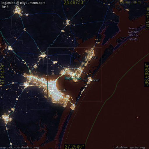
Analysis of Ingleside night lights 2016
Square area 10x10 km:
 5.87%
5.87%90-99
6.25%80-89
12.69%70-79
7.58%60-69
15.15%50-59
13.45%40-49
10.04%30-39
8.33%20-29
16.29%10-19
4.36%0-9
0%Square area 50x50 km:
4.34%90-99
3.24%80-89
2.91%70-79
2.48%60-69
2.5%50-59
3.19%40-49
2.55%30-39
2.78%20-29
4.82%10-19
12.14%0-9
59.04%Clear (daylight) street map image can be seen on geolist.org.
Map coordinates:
28° 29' 51.1" North, 97° 54' 53.2" West
27° 52' 40.1" North, 97° 12' 42" West
27° 15' 16.2" North, 96° 30' 30.7" West
Some cities around Ingleside sort by population:
• Corpus Christi
20.1 km =12.5 mi,  244°
244°
• Kingsville
75.1 km =46.7 mi, 237°
• Portland
11 km =6.8 mi,  269°
269°
• Robstown
46 km =28.6 mi,  257°
257°
• Rockport
22.1 km =13.7 mi,  43°
43°
• Aransas Pass
7 km =4.3 mi,  59°
59°
• Sinton
34.1 km =21.2 mi,  301°
301°
• Mathis
65.1 km =40.5 mi,  291°
291°
4700033 (p: 9,695)
Sources (retrieved 2019-11-25):
» Earth at Night: Flat Maps 2012, 2016