Corpus Christi night lights from space
Night Light of Corpus Christi (Texas) from space (United States) Src. Average luminocity for 10x10km area is 68.8036% and for 50x50km: 26.9627%.
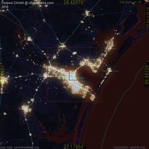
Analysis of Corpus Christi night lights 2016
Square area 10x10 km:
 33.73%
90-99
14.48%80-89
3.37%70-79
1.19%60-69
2.18%50-59
8.33%40-49
11.11%30-39
6.75%20-29
11.9%10-19
6.94%0-9
0%Square area 50x50 km:
5.25%90-99
4.23%80-89
3.45%70-79
3.28%60-69
3.44%50-59
4.31%40-49
3.48%30-39
3.59%20-29
7.45%10-19
13.81%0-9
47.71%Clear (daylight) street map image can be seen on geolist.org.
Map coordinates:
28° 25' 14.7" North, 98° 5' 58.2" West
27° 48' 2.1" North, 97° 23' 47" West
27° 10' 36.6" North, 96° 41' 35.7" West
Some cities around Corpus Christi sort by population:
• Kingsville
55.2 km =34.3 mi,  235°
235°
• Portland
11.1 km =6.9 mi,  39°
39°
• Robstown
26.8 km =16.7 mi,  267°
267°
• Rockport
41.4 km =25.7 mi,  53°
53°
• Ingleside
20.1 km =12.5 mi,  64°
64°
• Aransas Pass
27.1 km =16.8 mi, 63°
• Sinton
28.5 km =17.7 mi,  337°
337°
• Mathis
53.5 km =33.2 mi,  307°
307°
4683416 (p: 324,074)
Sources (retrieved 2019-11-25):
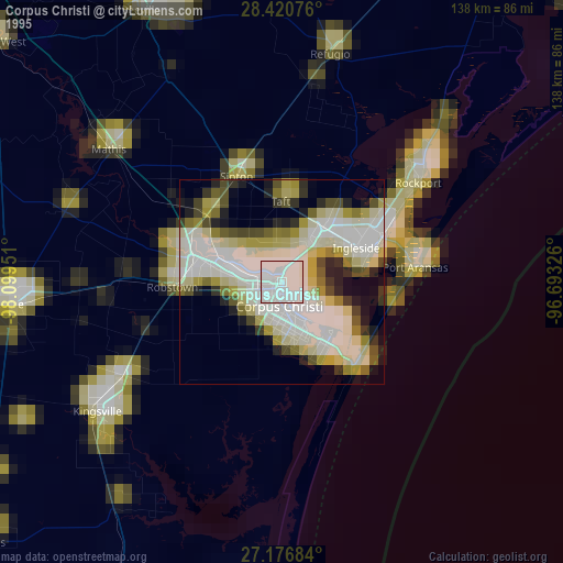
» NASA, Earths city lights 1995
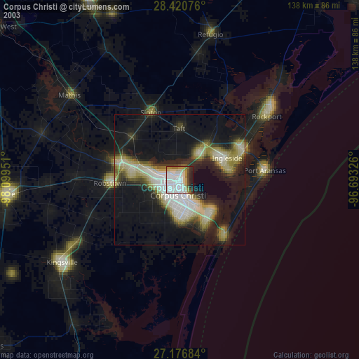
» NASA city lights 2003
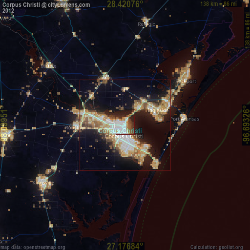
» Earth at Night: Flat Maps 2012, 2016