Schofield Barracks night lights from space
Night Light of Schofield Barracks (Hawaii) from space (United States) Src. Average luminocity for 10x10km area is 31.2216% and for 50x50km: 16.4746%.
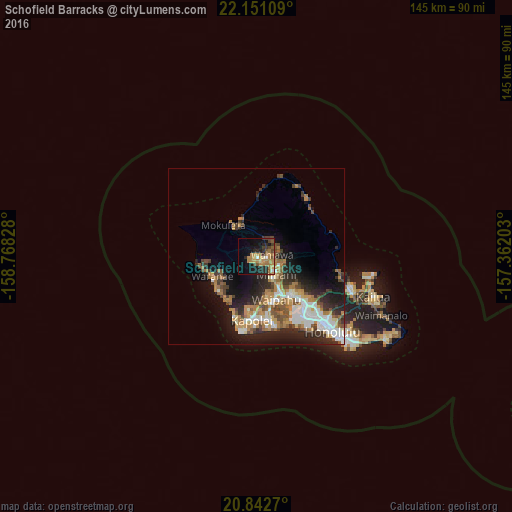
Analysis of Schofield Barracks night lights 2016
Square area 10x10 km:
 1.52%
1.52%90-99
0.95%80-89
2.08%70-79
9.47%60-69
11.17%50-59
3.79%40-49
5.11%30-39
3.22%20-29
11.17%10-19
21.21%0-9
30.3%Square area 50x50 km:
2.69%90-99
2.64%80-89
1.14%70-79
2.63%60-69
3.48%50-59
2.08%40-49
2.34%30-39
2.25%20-29
5.11%10-19
8.62%0-9
67.03%Clear (daylight) street map image can be seen on geolist.org.
Map coordinates:
22° 9' 3.9" North, 158° 46' 5.8" West
21° 29' 54.1" North, 158° 3' 54.5" West
20° 50' 33.7" North, 157° 21' 43.3" West
Some cities around Schofield Barracks sort by population:
• Waipahu
13.7 km =8.5 mi,  154°
154°
• Mililani Town
7.4 km =4.6 mi,  135°
135°
• Wahiawā
4.2 km =2.6 mi,  83°
83°
• Royal Kunia
12.3 km =7.6 mi,  161°
161°
• Waianae
14.2 km =8.8 mi,  241°
241°
• Waipio
11.2 km =7 mi, 142°
• Village Park
11.7 km =7.3 mi, 162°
• Waipi‘o Acres
6.5 km =4 mi,  124°
124°
7262790 (p: 16,370)
Sources (retrieved 2019-11-25):
» Earth at Night: Flat Maps 2012, 2016