Santee night lights from space
Night Light of Santee (California) from space (United States) Src. Average luminocity for 10x10km area is 71.0472% and for 50x50km: 39.6335%.
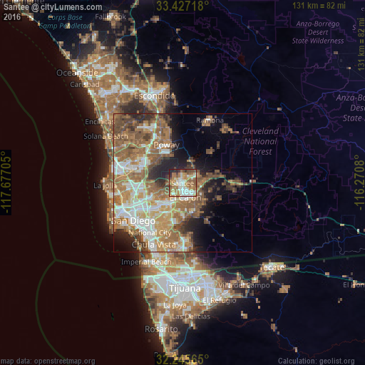
Analysis of Santee night lights 2016
Square area 10x10 km:
 13.81%
90-99
15.38%80-89
7.87%70-79
12.41%60-69
24.48%50-59
8.04%40-49
7.34%30-39
3.15%20-29
6.99%10-19
0.52%0-9
0%Square area 50x50 km:
6.48%90-99
6.79%80-89
3.54%70-79
5.69%60-69
12.07%50-59
8.54%40-49
5.7%30-39
3.73%20-29
5.15%10-19
7.33%0-9
34.98%Clear (daylight) street map image can be seen on geolist.org.
Map coordinates:
33° 25' 37.8" North, 117° 40' 37.4" West
32° 50' 18.2" North, 116° 58' 26.1" West
32° 14' 44.3" North, 116° 16' 14.9" West
Some cities around Santee sort by population:
• El Cajon
5 km =3.1 mi,  167°
167°
• La Mesa
9.1 km =5.7 mi,  210°
210°
• Spring Valley
10.7 km =6.6 mi,  192°
192°
• Lakeside
5.3 km =3.3 mi,  66°
66°
• Winter Gardens
3.9 km =2.4 mi,  101°
101°
• Casa de Oro-Mount Helix
8.3 km =5.2 mi,  176°
176°
• Bostonia
4.9 km =3 mi,  134°
134°
• Eucalyptus Hills
5.3 km =3.3 mi,  28°
28°
5393429 (p: 57,787)
Sources (retrieved 2019-11-25):
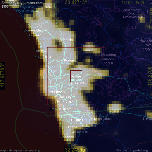
» NASA, Earths city lights 1995
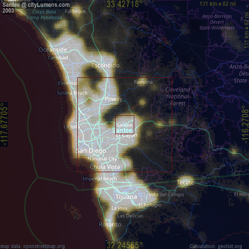
» NASA city lights 2003
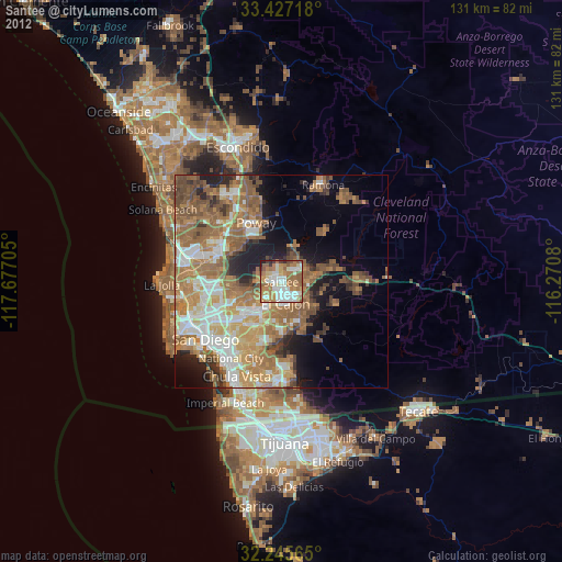
» Earth at Night: Flat Maps 2012, 2016