Saint Gabriel night lights from space
Night Light of Saint Gabriel (Louisiana) from space (United States) Src. Average luminocity for 10x10km area is 61.722% and for 50x50km: 46.685%.
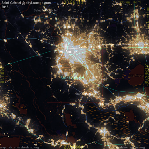
Analysis of Saint Gabriel night lights 2016
Square area 10x10 km:
 7.52%
7.52%90-99
6.29%80-89
15.03%70-79
8.74%60-69
9.97%50-59
10.84%40-49
27.1%30-39
8.74%20-29
5.77%10-19
0%0-9
0%Square area 50x50 km:
9.6%90-99
6.76%80-89
8.39%70-79
7.72%60-69
9.3%50-59
6.18%40-49
8.33%30-39
5.39%20-29
5.36%10-19
6.66%0-9
26.31%Clear (daylight) street map image can be seen on geolist.org.
Map coordinates:
30° 51' 47.3" North, 91° 48' 8.6" West
30° 15' 27.7" North, 91° 5' 57.4" West
29° 38' 54.6" North, 90° 23' 46.1" West
Some cities around Saint Gabriel sort by population:
• Prairieville
13.2 km =8.2 mi,  67°
67°
• Gonzales
17.3 km =10.7 mi,  97°
97°
• Gardere
10.5 km =6.5 mi,  338°
338°
• Oak Hills Place
11.4 km =7.1 mi,  5°
5°
• Village Saint George
12 km =7.5 mi, 14°
• Old Jefferson
16 km =9.9 mi,  29°
29°
• Plaquemine
13.5 km =8.4 mi,  285°
285°
• Inniswold
16.4 km =10.2 mi, 5°
4339690 (p: 6,677)
Sources (retrieved 2019-11-25):
» Earth at Night: Flat Maps 2012, 2016