Rocky Point night lights from space
Night Light of Rocky Point (New York) from space (United States) Src. Average luminocity for 10x10km area is 31.8452% and for 50x50km: 27.8918%.
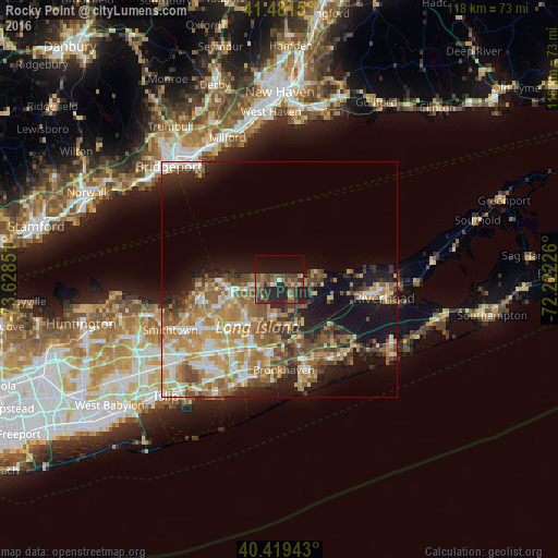
Analysis of Rocky Point night lights 2016
Square area 10x10 km:
 0.68%
0.68%90-99
1.19%80-89
3.06%70-79
3.91%60-69
5.95%50-59
9.35%40-49
11.05%30-39
7.31%20-29
17.01%10-19
22.62%0-9
17.86%Square area 50x50 km:
3.36%90-99
4.19%80-89
3.82%70-79
5.61%60-69
5.72%50-59
5.25%40-49
4.28%30-39
3.08%20-29
5.22%10-19
12.6%0-9
46.85%Clear (daylight) street map image can be seen on geolist.org.
Map coordinates:
41° 28' 53.4" North, 73° 37' 42.6" West
40° 57' 9.4" North, 72° 55' 31.4" West
40° 25' 9.9" North, 72° 13' 20.1" West
Some cities around Rocky Point sort by population:
• Ridge
7 km =4.3 mi,  159°
159°
• Miller Place
6 km =3.7 mi,  277°
277°
• Mount Sinai
8.8 km =5.5 mi,  265°
265°
• Middle Island
7.7 km =4.8 mi,  187°
187°
• Port Jefferson Station
10.7 km =6.6 mi,  253°
253°
• Wading River
7 km =4.3 mi,  92°
92°
• Sound Beach
3.6 km =2.2 mi, 276°
• East Shoreham
3.9 km =2.4 mi,  102°
102°
5134235 (p: 14,014)
Sources (retrieved 2019-11-25):
» Earth at Night: Flat Maps 2012, 2016