Rochester night lights from space
Night Light of Rochester (New York) from space (United States) Src. Average luminocity for 10x10km area is 96.8955% and for 50x50km: 25.144%.
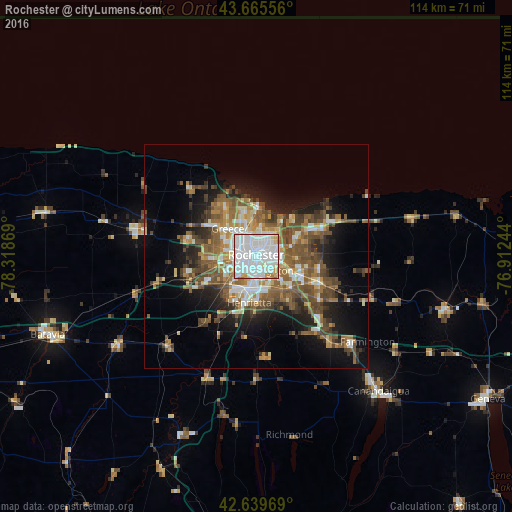
Analysis of Rochester night lights 2016
Square area 10x10 km:
 61.67%
90-99
27.27%80-89
4.55%70-79
4.7%60-69
1.82%50-59
0%40-49
0%30-39
0%20-29
0%10-19
0%0-9
0%Square area 50x50 km:
4.74%90-99
3.7%80-89
2.33%70-79
2.72%60-69
3.92%50-59
6.11%40-49
4.97%30-39
3.28%20-29
4.45%10-19
10.22%0-9
53.57%Clear (daylight) street map image can be seen on geolist.org.
Map coordinates:
43° 39' 56" North, 78° 19' 7.3" West
43° 9' 17.2" North, 77° 36' 56" West
42° 38' 22.9" North, 76° 54' 44.8" West
Some cities around Rochester sort by population:
• Irondequoit
7.1 km =4.4 mi,  24°
24°
• Brighton
5.3 km =3.3 mi,  98°
98°
• Gates-North Gates
7 km =4.3 mi,  279°
279°
• Greece
8.8 km =5.5 mi,  314°
314°
• North Gates
7.4 km =4.6 mi,  289°
289°
• East Rochester
11.6 km =7.2 mi,  116°
116°
• Webster
16.3 km =10.1 mi,  66°
66°
• Fairport
15.4 km =9.6 mi,  113°
113°
5134086 (p: 209,802)
Sources (retrieved 2019-11-25):
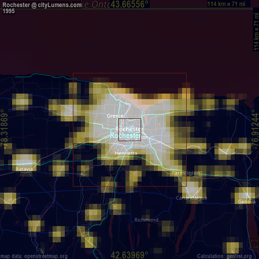
» NASA, Earths city lights 1995
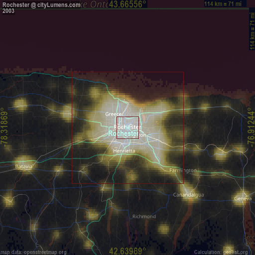
» NASA city lights 2003
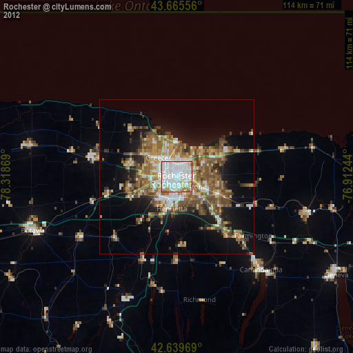
» Earth at Night: Flat Maps 2012, 2016