Irondequoit night lights from space
Night Light of Irondequoit (New York) from space (United States) Src. Average luminocity for 10x10km area is 69.3439% and for 50x50km: 24.0597%.
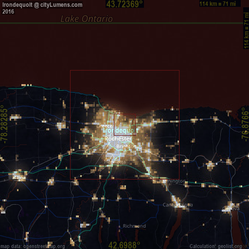
Analysis of Irondequoit night lights 2016
Square area 10x10 km:
 19.24%
90-99
13.48%80-89
9.7%70-79
10.91%60-69
9.85%50-59
13.18%40-49
6.82%30-39
4.85%20-29
6.36%10-19
5.61%0-9
0%Square area 50x50 km:
4.69%90-99
3.67%80-89
2.24%70-79
2.52%60-69
3.75%50-59
5.84%40-49
4.77%30-39
3.17%20-29
4.44%10-19
9.13%0-9
55.79%Clear (daylight) street map image can be seen on geolist.org.
Map coordinates:
43° 43' 25.3" North, 78° 16' 58.3" West
43° 12' 48.2" North, 77° 34' 47" West
42° 41' 55.7" North, 76° 52' 35.8" West
Some cities around Irondequoit sort by population:
• Rochester
7.1 km =4.4 mi,  204°
204°
• Brighton
7.7 km =4.8 mi,  162°
162°
• Gates-North Gates
11.2 km =7 mi,  241°
241°
• Greece
9.2 km =5.7 mi,  267°
267°
• North Gates
10.7 km =6.6 mi,  247°
247°
• East Rochester
13.8 km =8.6 mi,  147°
147°
• Webster
12.1 km =7.5 mi,  90°
90°
• Fairport
17 km =10.6 mi,  138°
138°
5122331 (p: 51,692)
Sources (retrieved 2019-11-25):
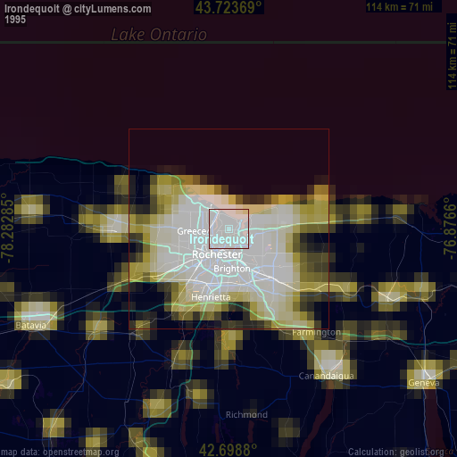
» NASA, Earths city lights 1995
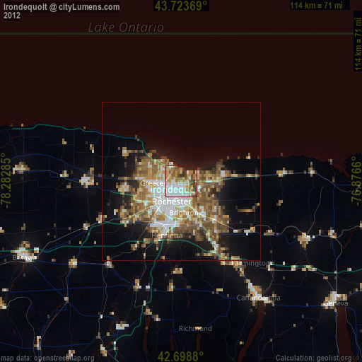
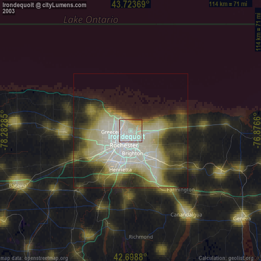
» NASA city lights 2003
» Earth at Night: Flat Maps 2012, 2016