Port Isabel night lights from space
Night Light of Port Isabel (Texas) from space (United States) Src. Average luminocity for 10x10km area is 26.4226% and for 50x50km: 6.8048%.
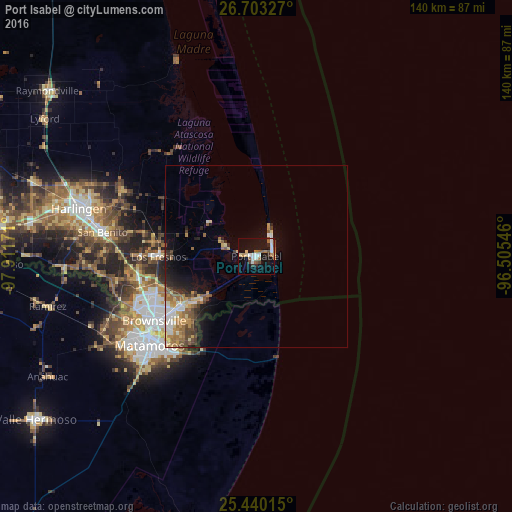
Analysis of Port Isabel night lights 2016
Square area 10x10 km:
 4.56%
4.56%90-99
4.56%80-89
2.98%70-79
1.19%60-69
5.36%50-59
3.77%40-49
2.18%30-39
1.19%20-29
2.38%10-19
31.15%0-9
40.67%Square area 50x50 km:
0.81%90-99
0.9%80-89
0.95%70-79
0.9%60-69
1.32%50-59
1.25%40-49
0.98%30-39
0.73%20-29
1.18%10-19
3.89%0-9
87.1%Clear (daylight) street map image can be seen on geolist.org.
Map coordinates:
26° 42' 11.8" North, 97° 54' 42.2" West
26° 4' 24.3" North, 97° 12' 30.9" West
25° 26' 24.5" North, 96° 30' 19.7" West
Some cities around Port Isabel sort by population:
• Heroica Matamoros, MX
36.6 km =22.7 mi,  233°
233°
• Brownsville
34.6 km =21.5 mi,  236°
236°
• Harlingen
50.4 km =31.3 mi,  284°
284°
• San Benito
42.7 km =26.5 mi, 278°
• La Feria
62.2 km =38.6 mi, 278°
• Cameron Park
29.4 km =18.3 mi,  245°
245°
• Cameron Park Colonia
29.2 km =18.1 mi, 247°
• Los Fresnos
26.7 km =16.6 mi,  269°
269°
4720060 (p: 5,016)
Sources (retrieved 2019-11-25):
» Earth at Night: Flat Maps 2012, 2016