Plantation night lights from space
Night Light of Plantation (Florida) from space (United States) Src. Average luminocity for 10x10km area is 98.7778% and for 50x50km: 58.2737%.
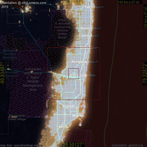
Analysis of Plantation night lights 2016
Square area 10x10 km:
 65.08%
90-99
32.74%80-89
2.18%70-79
0%60-69
0%50-59
0%40-49
0%30-39
0%20-29
0%10-19
0%0-9
0%Square area 50x50 km:
30.02%90-99
14.17%80-89
3.31%70-79
2.95%60-69
4.01%50-59
3.19%40-49
3.57%30-39
3.88%20-29
4.1%10-19
6.1%0-9
24.72%Clear (daylight) street map image can be seen on geolist.org.
Map coordinates:
26° 45' 49.5" North, 80° 56' 5.9" West
26° 8' 3.2" North, 80° 13' 54.6" West
25° 30' 4.6" North, 79° 31' 43.4" West
Some cities around Plantation sort by population:
• Fort Lauderdale
8.9 km =5.5 mi,  98°
98°
• Davie
7.9 km =4.9 mi,  180°
180°
• Lauderhill
2 km =1.2 mi,  69°
69°
• Tamarac
8.9 km =5.5 mi,  348°
348°
• Lauderdale Lakes
4.3 km =2.7 mi,  33°
33°
• Melrose Park
4.5 km =2.8 mi,  121°
121°
• Broadview Park
4.5 km =2.8 mi,  149°
149°
• Pine Island Ridge
6.1 km =3.8 mi,  223°
223°
4168782 (p: 92,560)
Sources (retrieved 2019-11-25):
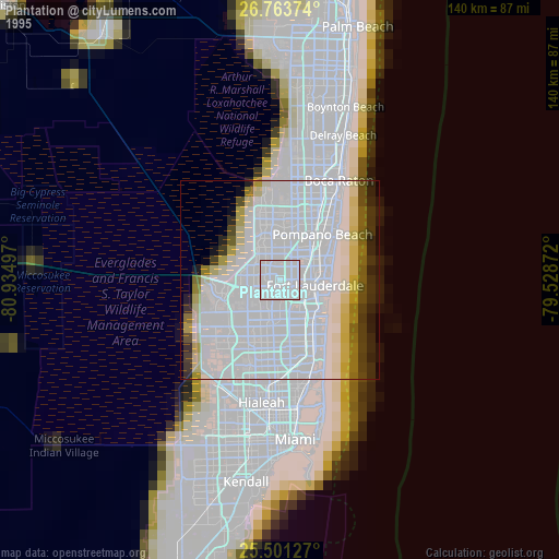
» NASA, Earths city lights 1995
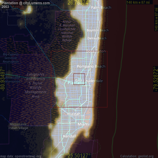
» NASA city lights 2003
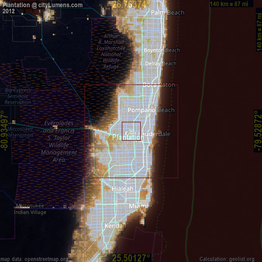
» Earth at Night: Flat Maps 2012, 2016