Pearl night lights from space
Night Light of Pearl (Mississippi) from space (United States) Src. Average luminocity for 10x10km area is 82.9432% and for 50x50km: 37.8462%.
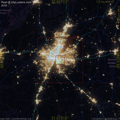
Analysis of Pearl night lights 2016
Square area 10x10 km:
 19.96%
90-99
21.25%80-89
15.02%70-79
22.16%60-69
13%50-59
5.13%40-49
3.48%30-39
0%20-29
0%10-19
0%0-9
0%Square area 50x50 km:
5.75%90-99
6.27%80-89
6.19%70-79
6.33%60-69
8%50-59
4.22%40-49
5.15%30-39
6.07%20-29
7.51%10-19
10.86%0-9
33.64%Clear (daylight) street map image can be seen on geolist.org.
Map coordinates:
32° 52' 1.7" North, 90° 50' 6.6" West
32° 16' 28.5" North, 90° 7' 55.3" West
31° 40' 41.4" North, 89° 25' 44.1" West
Some cities around Pearl sort by population:
• Jackson
5.6 km =3.5 mi,  298°
298°
• Madison
20.9 km =13 mi,  4°
4°
• Clinton
19.3 km =12 mi,  292°
292°
• Ridgeland
17.1 km =10.6 mi,  359°
359°
• Brandon
13.7 km =8.5 mi,  90°
90°
• Byram
15 km =9.3 mi,  225°
225°
• Flowood
3.9 km =2.4 mi,  350°
350°
• Richland
4.7 km =2.9 mi,  212°
212°
4440559 (p: 26,462)
Sources (retrieved 2019-11-25):
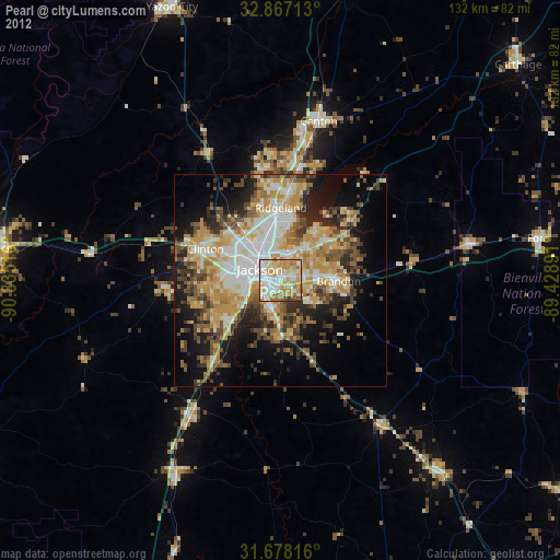
» Earth at Night: Flat Maps 2012, 2016