Clinton night lights from space
Night Light of Clinton (Mississippi) from space (United States) Src. Average luminocity for 10x10km area is 68.7033% and for 50x50km: 33.3649%.
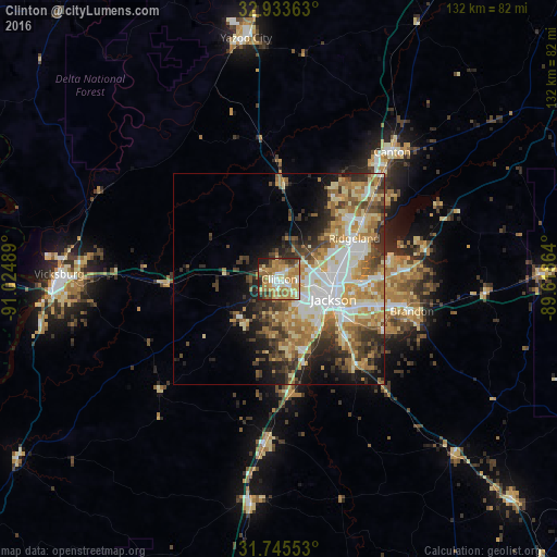
Analysis of Clinton night lights 2016
Square area 10x10 km:
 6.78%
6.78%90-99
13.37%80-89
15.93%70-79
19.23%60-69
17.22%50-59
5.49%40-49
6.96%30-39
6.59%20-29
6.23%10-19
2.2%0-9
0%Square area 50x50 km:
5.5%90-99
6.29%80-89
5.8%70-79
5.42%60-69
6.36%50-59
3.72%40-49
4.38%30-39
4.99%20-29
5.61%10-19
7.59%0-9
44.33%Clear (daylight) street map image can be seen on geolist.org.
Map coordinates:
32° 56' 1.1" North, 91° 1' 29.6" West
32° 20' 29.5" North, 90° 19' 18.3" West
31° 44' 43.9" North, 89° 37' 7.1" West
Some cities around Clinton sort by population:
• Jackson
13.7 km =8.5 mi,  110°
110°
• Pearl
19.3 km =12 mi, 112°
• Madison
23.5 km =14.6 mi,  55°
55°
• Ridgeland
20.2 km =12.6 mi, 61°
• Brandon
32.5 km =20.2 mi,  103°
103°
• Byram
19.4 km =12.1 mi,  158°
158°
• Flowood
17.5 km =10.9 mi, 101°
• Richland
19.1 km =11.9 mi,  126°
126°
4422133 (p: 25,254)
Sources (retrieved 2019-11-25):
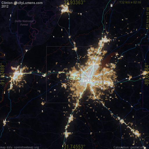
» Earth at Night: Flat Maps 2012, 2016