Byram night lights from space
Night Light of Byram (Mississippi) from space (United States) Src. Average luminocity for 10x10km area is 43.771% and for 50x50km: 31.2918%.
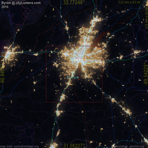
Analysis of Byram night lights 2016
Square area 10x10 km:
 3.67%
3.67%90-99
3.5%80-89
8.57%70-79
8.39%60-69
12.24%50-59
2.27%40-49
7.17%30-39
8.57%20-29
19.58%10-19
19.76%0-9
6.29%Square area 50x50 km:
5.03%90-99
5.54%80-89
5.15%70-79
5.14%60-69
6.73%50-59
3.07%40-49
4.14%30-39
4.98%20-29
4.8%10-19
8.33%0-9
47.08%Clear (daylight) street map image can be seen on geolist.org.
Map coordinates:
32° 46' 20.9" North, 90° 56' 54.6" West
32° 10' 45.6" North, 90° 14' 43.3" West
31° 34' 56.2" North, 89° 32' 32.1" West
Some cities around Byram sort by population:
• Jackson
14.5 km =9 mi,  23°
23°
• Pearl
15 km =9.3 mi,  45°
45°
• Madison
33.7 km =20.9 mi, 21°
• Clinton
19.4 km =12.1 mi,  338°
338°
• Ridgeland
29.7 km =18.5 mi, 20°
• Brandon
26.5 km =16.5 mi,  66°
66°
• Flowood
17.6 km =10.9 mi,  34°
34°
• Richland
10.5 km =6.5 mi, 50°
4420177 (p: 11,509)
Sources (retrieved 2019-11-25):
» Earth at Night: Flat Maps 2012, 2016