Brandon night lights from space
Night Light of Brandon (Mississippi) from space (United States) Src. Average luminocity for 10x10km area is 55.2125% and for 50x50km: 28.3645%.
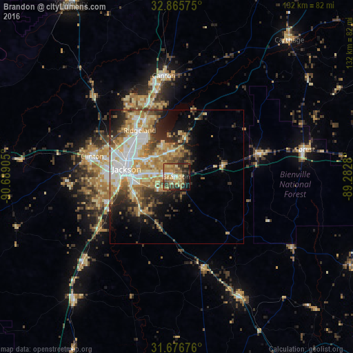
Analysis of Brandon night lights 2016
Square area 10x10 km:
 4.58%
4.58%90-99
3.48%80-89
10.44%70-79
11.36%60-69
22.16%50-59
7.51%40-49
8.42%30-39
9.71%20-29
11.54%10-19
10.07%0-9
0.73%Square area 50x50 km:
5.05%90-99
5.09%80-89
4.45%70-79
4.73%60-69
5.59%50-59
3.02%40-49
3.23%30-39
3.99%20-29
5.28%10-19
7.03%0-9
52.55%Clear (daylight) street map image can be seen on geolist.org.
Map coordinates:
32° 51' 56.7" North, 90° 41' 20.6" West
32° 16' 23.5" North, 89° 59' 9.3" West
31° 40' 36.3" North, 89° 16' 58.1" West
Some cities around Brandon sort by population:
• Jackson
18.9 km =11.7 mi,  278°
278°
• Pearl
13.7 km =8.5 mi,  270°
270°
• Madison
24.2 km =15 mi,  329°
329°
• Clinton
32.5 km =20.2 mi, 283°
• Ridgeland
22.1 km =13.7 mi,  321°
321°
• Byram
26.5 km =16.5 mi,  246°
246°
• Flowood
14.9 km =9.3 mi,  285°
285°
• Richland
16.7 km =10.4 mi,  256°
256°
4419290 (p: 23,529)
Sources (retrieved 2019-11-25):
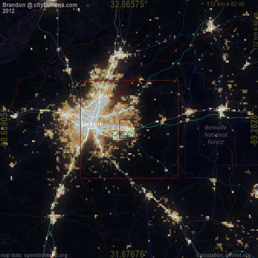
» Earth at Night: Flat Maps 2012, 2016