Palmyra night lights from space
Night Light of Palmyra (New Jersey) from space (United States) Src. Average luminocity for 10x10km area is 94.8605% and for 50x50km: 78.1074%.
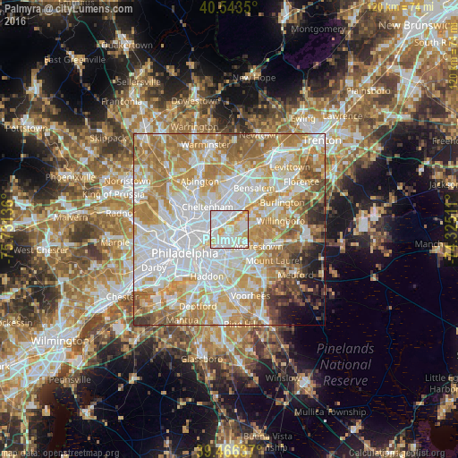
Analysis of Palmyra night lights 2016
Square area 10x10 km:
 43.37%
90-99
33.33%80-89
15.31%70-79
7.99%60-69
0%50-59
0%40-49
0%30-39
0%20-29
0%10-19
0%0-9
0%Square area 50x50 km:
25.19%90-99
18.35%80-89
11.22%70-79
13.68%60-69
13.41%50-59
6.22%40-49
3.48%30-39
2.59%20-29
1.98%10-19
2.49%0-9
1.4%Clear (daylight) street map image can be seen on geolist.org.
Map coordinates:
40° 32' 36.6" North, 75° 43' 52.9" West
40° 0' 25.4" North, 75° 1' 41.6" West
39° 27' 58.9" North, 74° 19' 30.4" West
Some cities around Palmyra sort by population:
• Cherry Hill
8 km =5 mi,  181°
181°
• Pennsauken
6.2 km =3.9 mi,  204°
204°
• Maple Shade
6.8 km =4.2 mi,  153°
153°
• Cinnaminson
3.2 km =2 mi,  110°
110°
• Moorestown-Lenola
7.1 km =4.4 mi,  130°
130°
• Cherry Hill Mall
8.1 km =5 mi,  168°
168°
• Tacony
3 km =1.9 mi,  332°
332°
• Kingston Estates
9.9 km =6.2 mi,  159°
159°
5102378 (p: 7,314)
Sources (retrieved 2019-11-25):
» Earth at Night: Flat Maps 2012, 2016