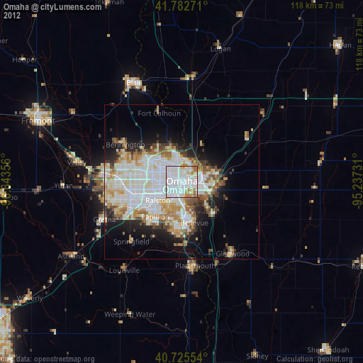
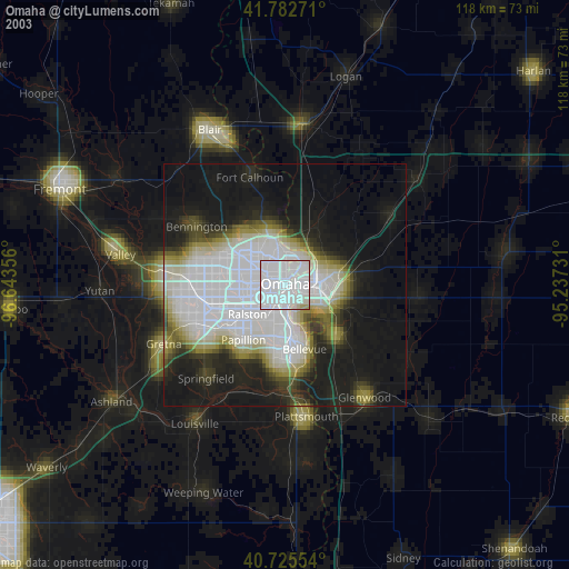
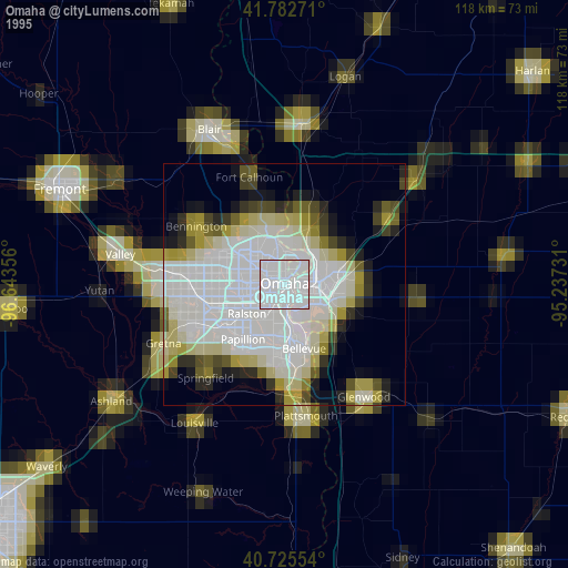
Omaha night lights from space
Night Light of Omaha (Nebraska) from space (United States) Src. Average luminocity for 10x10km area is 94.4497% and for 50x50km: 32.1991%.
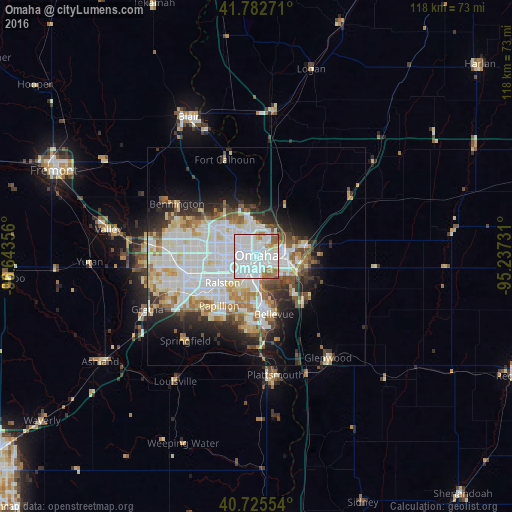
Analysis of Omaha night lights 2016
Square area 10x10 km:
 59.9%
59.9%90-99
23.86%80-89
2.27%70-79
4.22%60-69
7.95%50-59
1.79%40-49
0%30-39
0%20-29
0%10-19
0%0-9
0%Square area 50x50 km:
10.35%90-99
8.47%80-89
3.2%70-79
2.68%60-69
3.52%50-59
2.76%40-49
2.66%30-39
2.92%20-29
5.03%10-19
7.52%0-9
50.88%Clear (daylight) street map image can be seen on geolist.org.
Map coordinates:
41° 46' 57.8" North, 96° 38' 36.8" West
41° 15' 22.5" North, 95° 56' 25.5" West
40° 43' 31.9" North, 95° 14' 14.3" West
Some cities around Omaha sort by population:
• Council Bluffs
6.7 km =4.2 mi,  84°
84°
• Bellevue
13.9 km =8.6 mi,  162°
162°
• Papillion
14.2 km =8.8 mi,  216°
216°
• La Vista
11.1 km =6.9 mi, 223°
• Chalco
19.3 km =12 mi,  245°
245°
• Elkhorn
24.8 km =15.4 mi,  277°
277°
• Plattsmouth
27.7 km =17.2 mi,  169°
169°
• Ralston
10.2 km =6.3 mi,  236°
236°
5074472 (p: 443,885)
Sources (retrieved 2019-11-25):
» NASA, Earths city lights 1995
» NASA city lights 2003
» Earth at Night: Flat Maps 2012, 2016