Norwood night lights from space
Night Light of Norwood (New Jersey) from space (United States) Src. Average luminocity for 10x10km area is 63.3912% and for 50x50km: 68.7731%.
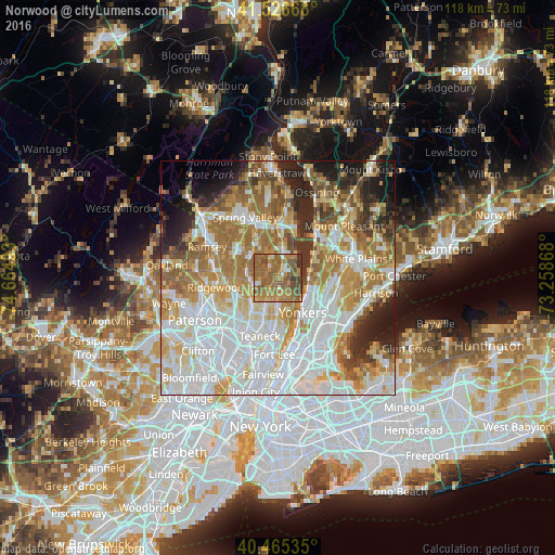
Analysis of Norwood night lights 2016
Square area 10x10 km:
 3.57%
3.57%90-99
3.23%80-89
3.91%70-79
17.86%60-69
29.76%50-59
30.27%40-49
7.31%30-39
4.08%20-29
0%10-19
0%0-9
0%Square area 50x50 km:
21.53%90-99
15.86%80-89
7.77%70-79
9.54%60-69
12.74%50-59
7.17%40-49
4.32%30-39
4.48%20-29
6.48%10-19
5.95%0-9
4.16%Clear (daylight) street map image can be seen on geolist.org.
Map coordinates:
41° 31' 36" North, 74° 39' 53.7" West
40° 59' 53.3" North, 73° 57' 42.5" West
40° 27' 55.3" North, 73° 15' 31.2" West
Some cities around Norwood sort by population:
• Westwood
6 km =3.7 mi,  262°
262°
• River Vale
4.2 km =2.6 mi,  265°
265°
• Cresskill
6.3 km =3.9 mi,  178°
178°
• Closter
2.8 km =1.7 mi, 179°
• Emerson
5.9 km =3.7 mi,  245°
245°
• Tappan
2.9 km =1.8 mi,  24°
24°
• Old Tappan
2.8 km =1.7 mi,  299°
299°
• Demarest
4.5 km =2.8 mi, 181°
5101978 (p: 5,869)
Sources (retrieved 2019-11-25):
» Earth at Night: Flat Maps 2012, 2016