Northfield night lights from space
Night Light of Northfield (New Hampshire) from space (United States) Src. Average luminocity for 10x10km area is 13.3% and for 50x50km: 3.6109%.
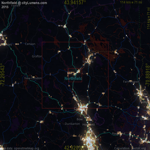
Analysis of Northfield night lights 2016
Square area 10x10 km:
 0.79%
0.79%90-99
2.38%80-89
0%70-79
2.06%60-69
2.06%50-59
3.49%40-49
4.6%30-39
0.79%20-29
1.27%10-19
0.16%0-9
82.38%Square area 50x50 km:
0.25%90-99
0.39%80-89
0.3%70-79
0.41%60-69
0.47%50-59
0.76%40-49
0.9%30-39
0.55%20-29
0.93%10-19
2.03%0-9
93%Clear (daylight) street map image can be seen on geolist.org.
Map coordinates:
43° 56' 29.7" North, 72° 17' 43.5" West
43° 25' 59.3" North, 71° 35' 32.3" West
42° 55' 13.4" North, 70° 53' 21" West
Some cities around Northfield sort by population:
• Concord
25.4 km =15.8 mi,  169°
169°
• East Concord
21.7 km =13.5 mi, 168°
• Laconia
14.4 km =8.9 mi,  43°
43°
• Franklin
4.6 km =2.9 mi,  285°
285°
• Bow Bog
35.4 km =22 mi, 169°
• Gilford
19.6 km =12.2 mi,  49°
49°
• Pembroke
33.7 km =20.9 mi,  161°
161°
• Hopkinton
27.7 km =17.2 mi,  194°
194°
5090459 (p: 5,049)
Sources (retrieved 2019-11-25):
» Earth at Night: Flat Maps 2012, 2016