Laconia night lights from space
Night Light of Laconia (New Hampshire) from space (United States) Src. Average luminocity for 10x10km area is 18.4016% and for 50x50km: 2.4174%.
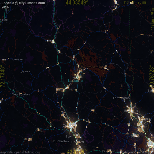
Analysis of Laconia night lights 2016
Square area 10x10 km:
 0.48%
0.48%90-99
1.43%80-89
3.81%70-79
1.27%60-69
3.02%50-59
4.44%40-49
4.29%30-39
3.49%20-29
1.59%10-19
12.38%0-9
63.81%Square area 50x50 km:
0.07%90-99
0.25%80-89
0.18%70-79
0.34%60-69
0.4%50-59
0.58%40-49
0.64%30-39
0.44%20-29
0.45%10-19
0.59%0-9
96.05%Clear (daylight) street map image can be seen on geolist.org.
Map coordinates:
44° 2' 7.8" North, 72° 10' 24.5" West
43° 31' 40.3" North, 71° 28' 13.3" West
43° 0' 57.2" North, 70° 46' 2" West
Some cities around Laconia sort by population:
• Concord
36 km =22.4 mi,  188°
188°
• East Concord
32.2 km =20 mi, 189°
• Franklin
17 km =10.6 mi,  236°
236°
• Gilford
5.6 km =3.5 mi,  66°
66°
• Pembroke
42.4 km =26.3 mi,  178°
178°
• Hopkinton
40.9 km =25.4 mi,  203°
203°
• Northfield
14.4 km =8.9 mi,  223°
223°
• Moultonborough
25.9 km =16.1 mi,  13°
13°
5088438 (p: 16,227)
Sources (retrieved 2019-11-25):
» Earth at Night: Flat Maps 2012, 2016