Newport night lights from space
Night Light of Newport (Oregon) from space (United States) Src. Average luminocity for 10x10km area is 14.3303% and for 50x50km: 0.9188%.
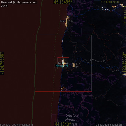
Analysis of Newport night lights 2016
Square area 10x10 km:
 1.97%
1.97%90-99
1.67%80-89
2.73%70-79
2.27%60-69
0.76%50-59
1.52%40-49
1.36%30-39
1.06%20-29
2.73%10-19
4.7%0-9
79.24%Square area 50x50 km:
0.09%90-99
0.08%80-89
0.15%70-79
0.11%60-69
0.1%50-59
0.16%40-49
0.14%30-39
0.15%20-29
0.15%10-19
0.27%0-9
98.61%Clear (daylight) street map image can be seen on geolist.org.
Map coordinates:
45° 8' 5.8" North, 124° 45' 23.7" West
44° 38' 12.4" North, 124° 3' 12.4" West
44° 8' 3.5" North, 123° 21' 1.2" West
Some cities around Newport sort by population:
• Corvallis
63.2 km =39.3 mi,  97°
97°
• Albany
75 km =46.6 mi,  90°
90°
• Dallas
66.1 km =41.1 mi,  61°
61°
• Monmouth
68.9 km =42.8 mi,  70°
70°
• Independence
72.5 km =45 mi, 70°
• Florence
72.8 km =45.2 mi,  182°
182°
• Lincoln City
35.8 km =22.2 mi,  4°
4°
• Sheridan
73.1 km =45.4 mi,  45°
45°
5742750 (p: 10,268)
Sources (retrieved 2019-11-25):
» Earth at Night: Flat Maps 2012, 2016