Mount Arlington night lights from space
Night Light of Mount Arlington (New Jersey) from space (United States) Src. Average luminocity for 10x10km area is 47.0935% and for 50x50km: 25.9407%.
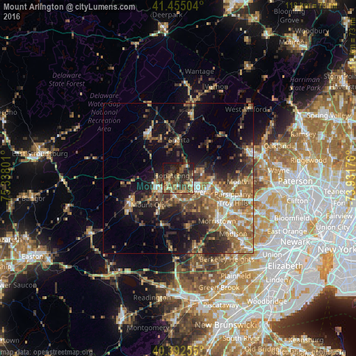
Analysis of Mount Arlington night lights 2016
Square area 10x10 km:
 1.53%
1.53%90-99
2.04%80-89
11.39%70-79
6.8%60-69
7.99%50-59
9.01%40-49
20.58%30-39
10.88%20-29
17.35%10-19
12.07%0-9
0.34%Square area 50x50 km:
2.58%90-99
2.86%80-89
2.92%70-79
3.95%60-69
5.78%50-59
5.26%40-49
5.1%30-39
4.8%20-29
6.61%10-19
13.14%0-9
46.99%Clear (daylight) street map image can be seen on geolist.org.
Map coordinates:
41° 27' 18.1" North, 75° 20' 16.8" West
40° 55' 33.3" North, 74° 38' 5.6" West
40° 23' 33.2" North, 73° 55' 54.3" West
Some cities around Mount Arlington sort by population:
• Randolph
9.7 km =6 mi,  152°
152°
• Dover
7.7 km =4.8 mi,  127°
127°
• Hopatcong Hills
3.6 km =2.2 mi,  303°
303°
• Hopatcong
2.2 km =1.4 mi,  290°
290°
• Succasunna
6.4 km =4 mi,  184°
184°
• Budd Lake
10.3 km =6.4 mi,  233°
233°
• Wharton
5.8 km =3.6 mi, 129°
• Landing
3.4 km =2.1 mi, 227°
5101459 (p: 5,300)
Sources (retrieved 2019-11-25):
» Earth at Night: Flat Maps 2012, 2016