Hopatcong Hills night lights from space
Night Light of Hopatcong Hills (New Jersey) from space (United States) Src. Average luminocity for 10x10km area is 30.5782% and for 50x50km: 22.2384%.
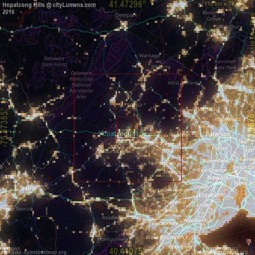
Analysis of Hopatcong Hills night lights 2016
Square area 10x10 km:
 0.68%
0.68%90-99
1.36%80-89
4.59%70-79
2.04%60-69
4.25%50-59
9.52%40-49
9.01%30-39
7.99%20-29
14.63%10-19
27.21%0-9
18.71%Square area 50x50 km:
2.19%90-99
2.39%80-89
2.4%70-79
3.19%60-69
4.61%50-59
4.47%40-49
4.48%30-39
4.35%20-29
5.9%10-19
12.55%0-9
53.48%Clear (daylight) street map image can be seen on geolist.org.
Map coordinates:
41° 28' 22.7" North, 75° 22' 25.9" West
40° 56' 38.4" North, 74° 40' 14.6" West
40° 24' 38.7" North, 73° 58' 3.4" West
Some cities around Hopatcong Hills sort by population:
• Sparta
10.3 km =6.4 mi,  15°
15°
• Dover
11.3 km =7 mi,  126°
126°
• Lake Mohawk
8.3 km =5.2 mi,  6°
6°
• Succasunna
8.8 km =5.5 mi,  163°
163°
• Budd Lake
9.7 km =6 mi,  213°
213°
• Wharton
9.4 km =5.8 mi, 127°
• Landing
4.3 km =2.7 mi,  173°
173°
• Mount Arlington
3.6 km =2.2 mi,  123°
123°
5099292 (p: 16,267)
Sources (retrieved 2019-11-25):
» Earth at Night: Flat Maps 2012, 2016