Morristown night lights from space
Night Light of Morristown (New Jersey) from space (United States) Src. Average luminocity for 10x10km area is 65.9286% and for 50x50km: 55.4911%.
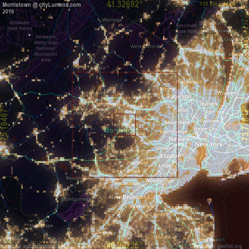
Analysis of Morristown night lights 2016
Square area 10x10 km:
 10.2%
10.2%90-99
15.99%80-89
9.52%70-79
10.71%60-69
10.88%50-59
12.76%40-49
11.22%30-39
8.16%20-29
8.33%10-19
2.21%0-9
0%Square area 50x50 km:
12.33%90-99
10.53%80-89
7.46%70-79
9.61%60-69
9.74%50-59
8.65%40-49
6.9%30-39
5.19%20-29
6.46%10-19
10.68%0-9
12.46%Clear (daylight) street map image can be seen on geolist.org.
Map coordinates:
41° 19' 36.9" North, 75° 11' 4.8" West
40° 47' 48.4" North, 74° 28' 53.5" West
40° 15' 44.5" North, 73° 46' 42.3" West
Some cities around Morristown sort by population:
• Parsippany
8.2 km =5.1 mi,  34°
34°
• Randolph
10.2 km =6.3 mi,  304°
304°
• Madison
6.8 km =4.2 mi,  127°
127°
• Hanover
9.7 km =6 mi,  84°
84°
• East Hanover
10.2 km =6.3 mi, 75°
• Florham Park
7.9 km =4.9 mi,  97°
97°
• Chatham
10.3 km =6.4 mi, 127°
• Mendham
10.3 km =6.4 mi,  256°
256°
5101427 (p: 18,594)
Sources (retrieved 2019-11-25):
» Earth at Night: Flat Maps 2012, 2016