Hanover night lights from space
Night Light of Hanover (New Jersey) from space (United States) Src. Average luminocity for 10x10km area is 76.9609% and for 50x50km: 68.1405%.
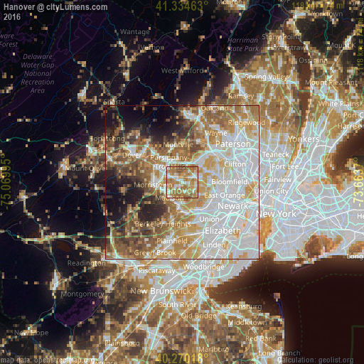
Analysis of Hanover night lights 2016
Square area 10x10 km:
 13.44%
90-99
14.12%80-89
11.22%70-79
17.52%60-69
34.52%50-59
6.8%40-49
2.38%30-39
0%20-29
0%10-19
0%0-9
0%Square area 50x50 km:
22.23%90-99
14.09%80-89
8.12%70-79
10.72%60-69
10.29%50-59
7.9%40-49
5.72%30-39
4.38%20-29
5.07%10-19
6.45%0-9
5.03%Clear (daylight) street map image can be seen on geolist.org.
Map coordinates:
41° 20' 4.7" North, 75° 4' 11.8" West
40° 48' 16.3" North, 74° 22' 0.6" West
40° 16' 12.6" North, 73° 39' 49.3" West
Some cities around Hanover sort by population:
• Livingston
4.5 km =2.8 mi,  102°
102°
• Madison
6.5 km =4 mi,  220°
220°
• Short Hills
7.2 km =4.5 mi,  151°
151°
• East Hanover
1.7 km =1.1 mi,  5°
5°
• Florham Park
2.6 km =1.6 mi, 224°
• Chatham
7.2 km =4.5 mi,  191°
191°
• Northfield
4.9 km =3 mi,  133°
133°
• Roseland
6.4 km =4 mi,  73°
73°
5098805 (p: 12,898)
Sources (retrieved 2019-11-25):
» Earth at Night: Flat Maps 2012, 2016