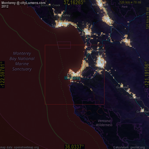
Monterey night lights from space
Night Light of Monterey (California) from space (United States) Src. Average luminocity for 10x10km area is 40% and for 50x50km: 7.3034%.
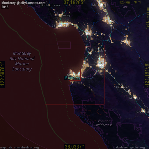
Analysis of Monterey night lights 2016
Square area 10x10 km:
 4.76%
4.76%90-99
6.04%80-89
0.92%70-79
9.89%60-69
4.95%50-59
5.31%40-49
7.88%30-39
8.61%20-29
14.29%10-19
34.62%0-9
2.75%Square area 50x50 km:
0.83%90-99
0.91%80-89
0.31%70-79
1.42%60-69
1.15%50-59
0.96%40-49
1%30-39
1.4%20-29
1.96%10-19
6.6%0-9
83.44%Clear (daylight) street map image can be seen on geolist.org.
Map coordinates:
37° 9' 45.5" North, 122° 35' 52.1" West
36° 36' 0.9" North, 121° 53' 40.8" West
36° 2' 1.3" North, 121° 11' 29.6" West
Some cities around Monterey sort by population:
• Salinas
23 km =14.3 mi,  68°
68°
• Watsonville
36.6 km =22.7 mi,  19°
19°
• Seaside
4 km =2.5 mi, 72°
• Marina
12.5 km =7.8 mi,  41°
41°
• Prunedale
28 km =17.4 mi,  45°
45°
• Pacific Grove
2.8 km =1.7 mi,  314°
314°
• Rio Del Mar
40.9 km =25.4 mi,  359°
359°
• Castroville
22.1 km =13.7 mi,  33°
33°
5374361 (p: 28,338)
Sources (retrieved 2019-11-25):
» Earth at Night: Flat Maps 2012, 2016