Melville night lights from space
Night Light of Melville (New York) from space (United States) Src. Average luminocity for 10x10km area is 82.2127% and for 50x50km: 51.1912%.
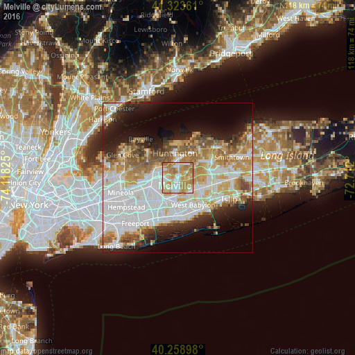
Analysis of Melville night lights 2016
Square area 10x10 km:
 16.56%
90-99
18.67%80-89
14.61%70-79
29.38%60-69
20.13%50-59
0.65%40-49
0%30-39
0%20-29
0%10-19
0%0-9
0%Square area 50x50 km:
16.11%90-99
11.78%80-89
6.21%70-79
7.43%60-69
6.49%50-59
5.21%40-49
3.35%30-39
2.9%20-29
6.12%10-19
9.53%0-9
24.88%Clear (daylight) street map image can be seen on geolist.org.
Map coordinates:
41° 19' 25" North, 74° 7' 5.7" West
40° 47' 36.3" North, 73° 24' 54.4" West
40° 15' 32.3" North, 72° 42' 43.2" West
Some cities around Melville sort by population:
• Huntington Station
6.7 km =4.2 mi,  2°
2°
• Plainview
4.8 km =3 mi,  246°
246°
• Wyandanch
6.4 km =4 mi,  133°
133°
• South Huntington
3.6 km =2.2 mi,  22°
22°
• Woodbury
5.7 km =3.5 mi,  309°
309°
• West Hills
2.9 km =1.8 mi,  330°
330°
• Old Bethpage
4.7 km =2.9 mi,  223°
223°
• Wheatley Heights
5 km =3.1 mi, 130°
5126555 (p: 18,985)
Sources (retrieved 2019-11-25):
» Earth at Night: Flat Maps 2012, 2016