Mākaha night lights from space
Night Light of Mākaha (Hawaii) from space (United States) Src. Average luminocity for 10x10km area is 14.9564% and for 50x50km: 9.9295%.
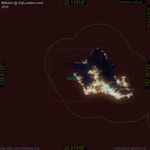
Analysis of Mākaha night lights 2016
Square area 10x10 km:
 0.19%
0.19%90-99
0.57%80-89
0%70-79
2.27%60-69
6.25%50-59
1.89%40-49
4.36%30-39
6.25%20-29
3.03%10-19
6.44%0-9
68.75%Square area 50x50 km:
0.91%90-99
0.94%80-89
0.67%70-79
2.12%60-69
2.86%50-59
1.56%40-49
1.68%30-39
1.17%20-29
2.99%10-19
6.05%0-9
79.07%Clear (daylight) street map image can be seen on geolist.org.
Map coordinates:
22° 7' 8.9" North, 158° 54' 48.6" West
21° 27' 58.6" North, 158° 12' 37.3" West
20° 48' 37.7" North, 157° 30' 26.1" West
Some cities around Mākaha sort by population:
• Makakilo
18 km =11.2 mi,  134°
134°
• Wahiawā
19.6 km =12.2 mi,  78°
78°
• Schofield Barracks
15.4 km =9.6 mi, 76°
• Makakilo City
18.5 km =11.5 mi,  135°
135°
• Waianae
4.1 km =2.5 mi, 140°
• Nānākuli
9.9 km =6.2 mi, 144°
• Village Park
20.1 km =12.5 mi,  112°
112°
• Mā‘ili
6.6 km =4.1 mi,  146°
146°
5850511 (p: 8,278)
Sources (retrieved 2019-11-25):
» Earth at Night: Flat Maps 2012, 2016