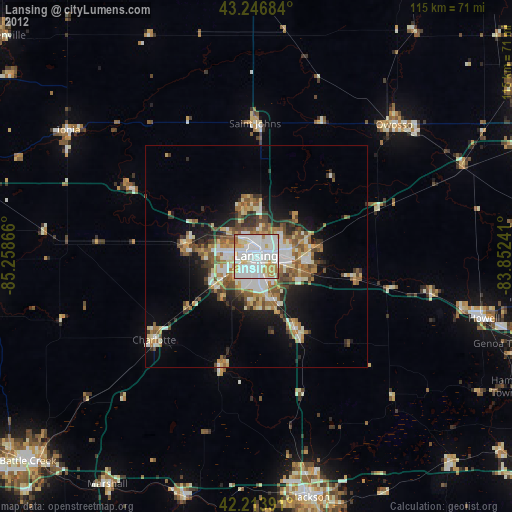
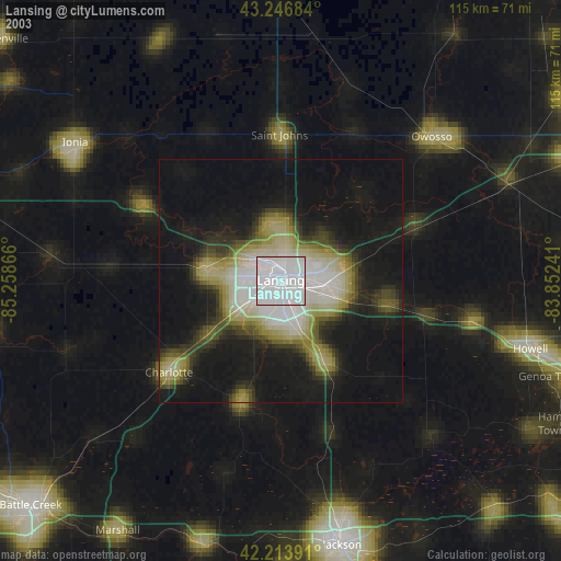
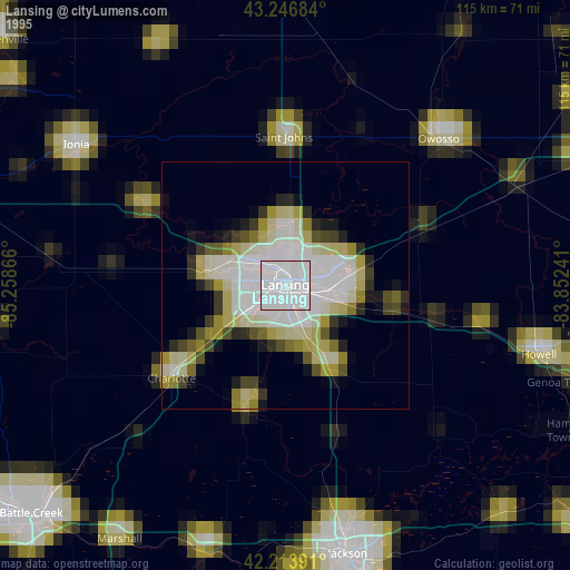
Lansing night lights from space
Night Light of Lansing (Michigan) from space (United States) Src. Average luminocity for 10x10km area is 92.8879% and for 50x50km: 16.7472%.
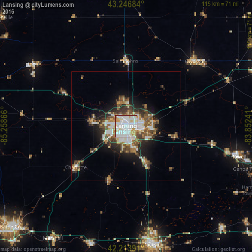
Analysis of Lansing night lights 2016
Square area 10x10 km:
 45.61%
90-99
30.3%80-89
6.67%70-79
10.45%60-69
5.76%50-59
0.76%40-49
0.45%30-39
0%20-29
0%10-19
0%0-9
0%Square area 50x50 km:
3.5%90-99
3.39%80-89
1.37%70-79
1.59%60-69
2.26%50-59
2.6%40-49
2.71%30-39
2.46%20-29
3.56%10-19
6.56%0-9
69.99%Clear (daylight) street map image can be seen on geolist.org.
Map coordinates:
43° 14' 48.6" North, 85° 15' 31.2" West
42° 43' 57.1" North, 84° 33' 19.9" West
42° 12' 50.1" North, 83° 51' 8.7" West
Some cities around Lansing sort by population:
• East Lansing
5.9 km =3.7 mi,  85°
85°
• Holt
10.7 km =6.6 mi,  162°
162°
• Waverly
5.4 km =3.4 mi,  277°
277°
• Okemos
10.5 km =6.5 mi,  96°
96°
• Haslett
12.7 km =7.9 mi,  82°
82°
• Mason
19.4 km =12.1 mi,  151°
151°
• Grand Ledge
15.8 km =9.8 mi, 278°
• Eaton Rapids
26.2 km =16.3 mi,  198°
198°
4998830 (p: 115,056)
Sources (retrieved 2019-11-25):
» NASA, Earths city lights 1995
» NASA city lights 2003
» Earth at Night: Flat Maps 2012, 2016