Knoxville night lights from space
Night Light of Knoxville (Iowa) from space (United States) Src. Average luminocity for 10x10km area is 14.0884% and for 50x50km: 2.1052%.
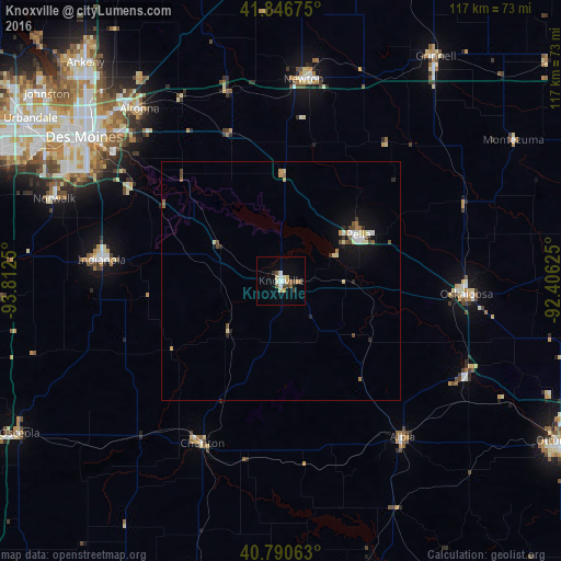
Analysis of Knoxville night lights 2016
Square area 10x10 km:
 1.7%
1.7%90-99
2.21%80-89
2.72%70-79
1.87%60-69
0.34%50-59
2.21%40-49
2.72%30-39
1.19%20-29
0.68%10-19
1.53%0-9
82.82%Square area 50x50 km:
0.25%90-99
0.31%80-89
0.33%70-79
0.22%60-69
0.19%50-59
0.3%40-49
0.38%30-39
0.16%20-29
0.31%10-19
1.16%0-9
96.4%Clear (daylight) street map image can be seen on geolist.org.
Map coordinates:
41° 50' 48.3" North, 93° 48' 45" West
41° 19' 15" North, 93° 6' 33.7" West
40° 47' 26.3" North, 92° 24' 22.5" West
Some cities around Knoxville sort by population:
• Des Moines
52 km =32.3 mi,  306°
306°
• Altoona
46.6 km =29 mi,  320°
320°
• Indianola
37.6 km =23.4 mi,  276°
276°
• Newton
42.4 km =26.3 mi,  6°
6°
• Oskaloosa
38.9 km =24.2 mi,  94°
94°
• Pella
18.8 km =11.7 mi,  58°
58°
• Norwalk
50.5 km =31.4 mi,  289°
289°
• Pleasant Hill
45 km =28 mi, 310°
4863705 (p: 7,248)
Sources (retrieved 2019-11-25):
» Earth at Night: Flat Maps 2012, 2016