Des Moines night lights from space
Night Light of Des Moines (Iowa) from space (United States) Src. Average luminocity for 10x10km area is 91.461% and for 50x50km: 26.4372%.
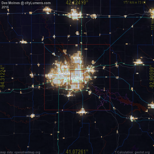
Analysis of Des Moines night lights 2016
Square area 10x10 km:
 36.85%
90-99
33.77%80-89
8.77%70-79
11.2%60-69
7.63%50-59
0.81%40-49
0.65%30-39
0.32%20-29
0%10-19
0%0-9
0%Square area 50x50 km:
5.61%90-99
5.82%80-89
3.49%70-79
3.52%60-69
3.28%50-59
3.7%40-49
2.96%30-39
2.51%20-29
4.95%10-19
9.23%0-9
54.95%Clear (daylight) street map image can be seen on geolist.org.
Map coordinates:
42° 7' 27.1" North, 94° 18' 44.1" West
41° 36' 1.9" North, 93° 36' 32.8" West
41° 4' 21.4" North, 92° 54' 21.6" West
Some cities around Des Moines sort by population:
• West Des Moines
8.9 km =5.5 mi,  253°
253°
• Ankeny
14.4 km =8.9 mi,  1°
1°
• Urbandale
9 km =5.6 mi,  288°
288°
• Johnston
10.9 km =6.8 mi,  317°
317°
• Altoona
12.9 km =8 mi,  68°
68°
• Clive
9.6 km =6 mi,  271°
271°
• Norwalk
15.1 km =9.4 mi,  202°
202°
• Pleasant Hill
7.6 km =4.7 mi,  104°
104°
4853828 (p: 210,330)
Sources (retrieved 2019-11-25):
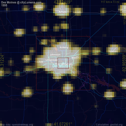
» NASA, Earths city lights 1995
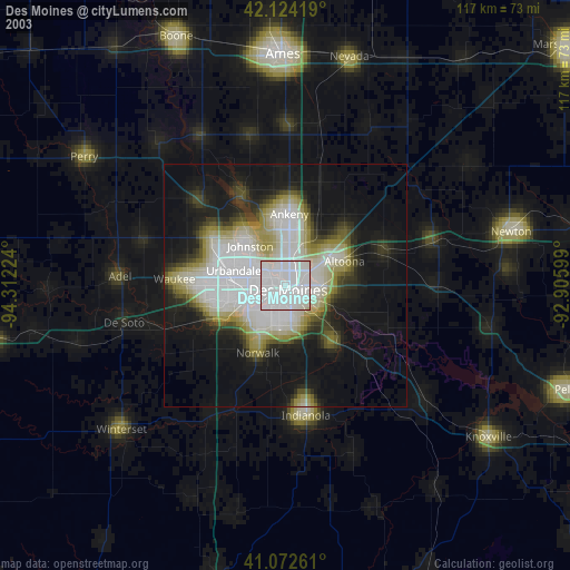
» NASA city lights 2003
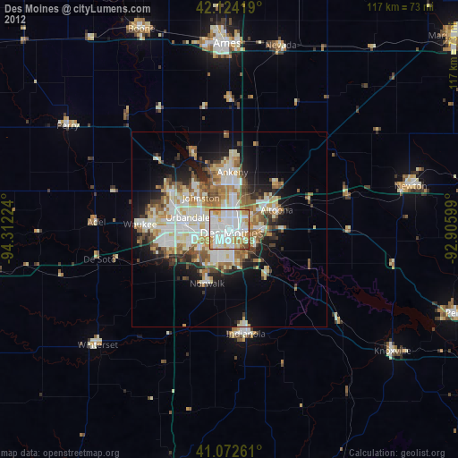
» Earth at Night: Flat Maps 2012, 2016