Keansburg night lights from space
Night Light of Keansburg (New Jersey) from space (United States) Src. Average luminocity for 10x10km area is 51.4235% and for 50x50km: 55.3376%.
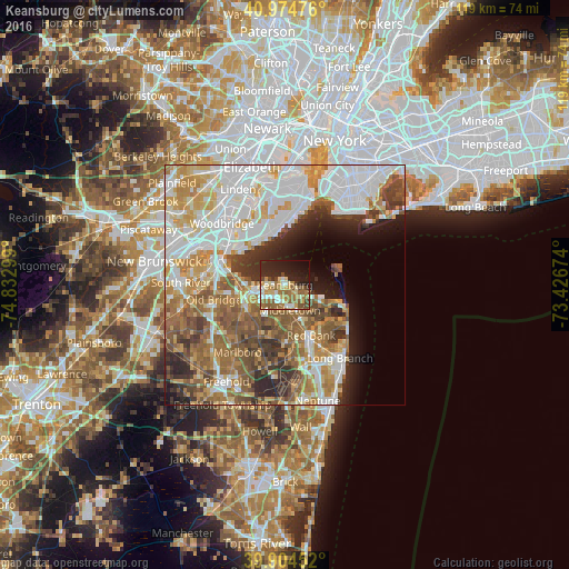
Analysis of Keansburg night lights 2016
Square area 10x10 km:
 4.25%
4.25%90-99
10.54%80-89
8.84%70-79
7.48%60-69
14.8%50-59
7.99%40-49
5.95%30-39
1.36%20-29
19.05%10-19
15.65%0-9
4.08%Square area 50x50 km:
15.7%90-99
11.47%80-89
6.61%70-79
7.4%60-69
8.98%50-59
8.81%40-49
5.44%30-39
5.17%20-29
6.13%10-19
5.52%0-9
18.76%Clear (daylight) street map image can be seen on geolist.org.
Map coordinates:
40° 58' 29.1" North, 74° 49' 58.8" West
40° 26' 30.4" North, 74° 7' 47.5" West
39° 54' 16.3" North, 73° 25' 36.3" West
Some cities around Keansburg sort by population:
• Red Bank
11.9 km =7.4 mi,  152°
152°
• Eltingville
11.9 km =7.4 mi,  345°
345°
• Matawan
9 km =5.6 mi,  250°
250°
• Strathmore
8.7 km =5.4 mi,  234°
234°
• Keyport
6 km =3.7 mi,  260°
260°
• Laurence Harbor
10 km =6.2 mi,  279°
279°
• Fair Haven
11.9 km =7.4 mi,  139°
139°
• Union Beach
4.1 km =2.5 mi, 277°
5099961 (p: 9,873)
Sources (retrieved 2019-11-25):
» Earth at Night: Flat Maps 2012, 2016