Janesville night lights from space
Night Light of Janesville (Wisconsin) from space (United States) Src. Average luminocity for 10x10km area is 61.7258% and for 50x50km: 10.3871%.
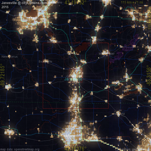
Analysis of Janesville night lights 2016
Square area 10x10 km:
 9.39%
9.39%90-99
13.18%80-89
13.64%70-79
8.48%60-69
8.48%50-59
12.42%40-49
7.42%30-39
5.15%20-29
11.52%10-19
10.15%0-9
0.15%Square area 50x50 km:
0.91%90-99
1.37%80-89
1.88%70-79
1.17%60-69
1.58%50-59
1.58%40-49
1.73%30-39
1.38%20-29
2.78%10-19
6.45%0-9
79.19%Clear (daylight) street map image can be seen on geolist.org.
Map coordinates:
43° 11' 51.1" North, 89° 43' 18.7" West
42° 40' 58" North, 89° 1' 7.4" West
42° 9' 49.5" North, 88° 18' 56.2" West
Some cities around Janesville sort by population:
• Beloit
19.4 km =12.1 mi,  183°
183°
• Whitewater
28.8 km =17.9 mi,  54°
54°
• Roscoe
30 km =18.6 mi, 178°
• South Beloit
21.1 km =13.1 mi, 184°
• Rockton
26 km =16.2 mi,  189°
189°
• Milton
12 km =7.5 mi,  30°
30°
• Edgerton
17.4 km =10.8 mi,  346°
346°
• Evansville
25.3 km =15.7 mi,  295°
295°
5257754 (p: 64,123)
Sources (retrieved 2019-11-25):
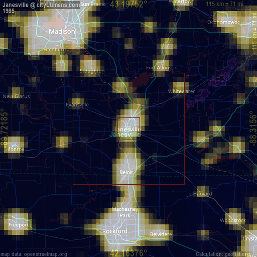
» NASA, Earths city lights 1995
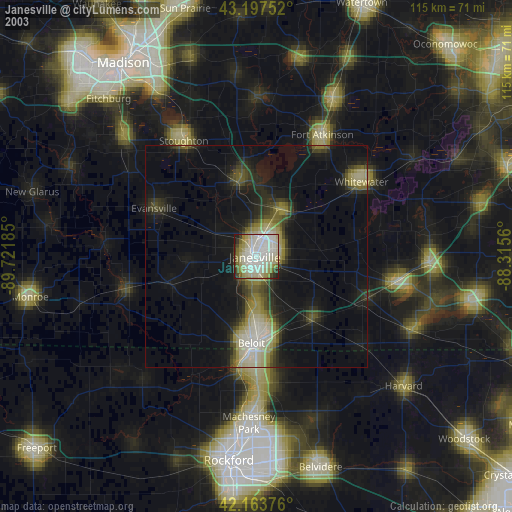
» NASA city lights 2003
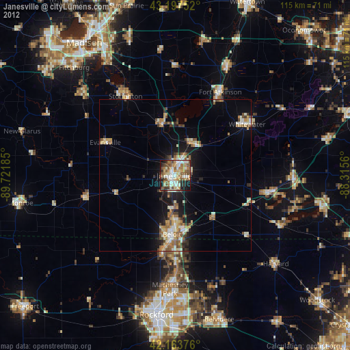
» Earth at Night: Flat Maps 2012, 2016