Evansville night lights from space
Night Light of Evansville (Wisconsin) from space (United States) Src. Average luminocity for 10x10km area is 5.7591% and for 50x50km: 7.8696%.
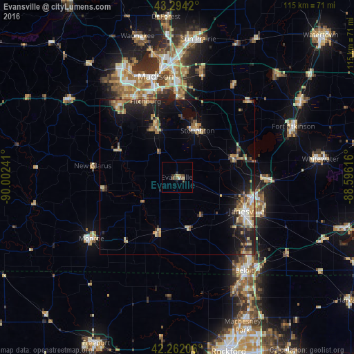
Analysis of Evansville night lights 2016
Square area 10x10 km:
 0.15%
0.15%90-99
0.45%80-89
0.61%70-79
1.06%60-69
0.15%50-59
1.97%40-49
2.27%30-39
1.21%20-29
0.61%10-19
0.61%0-9
90.91%Square area 50x50 km:
0.45%90-99
0.71%80-89
1.53%70-79
1.11%60-69
1.17%50-59
1.17%40-49
1.04%30-39
1.01%20-29
2.56%10-19
5.53%0-9
83.71%Clear (daylight) street map image can be seen on geolist.org.
Map coordinates:
43° 17' 39.1" North, 90° 0' 8.7" West
42° 46' 49" North, 89° 17' 57.4" West
42° 15' 43.4" North, 88° 35' 46.2" West
Some cities around Evansville sort by population:
• Janesville
25.3 km =15.7 mi,  115°
115°
• Fitchburg
24.4 km =15.2 mi,  325°
325°
• Stoughton
16.6 km =10.3 mi,  23°
23°
• Verona
30.2 km =18.8 mi,  320°
320°
• Oregon
17.6 km =10.9 mi,  336°
336°
• McFarland
25.8 km =16 mi,  1°
1°
• Milton
29 km =18 mi,  91°
91°
• Edgerton
19.9 km =12.4 mi,  72°
72°
5252182 (p: 5,228)
Sources (retrieved 2019-11-25):
» Earth at Night: Flat Maps 2012, 2016