Hillsdale night lights from space
Night Light of Hillsdale (New Jersey) from space (United States) Src. Average luminocity for 10x10km area is 70.3861% and for 50x50km: 67.485%.
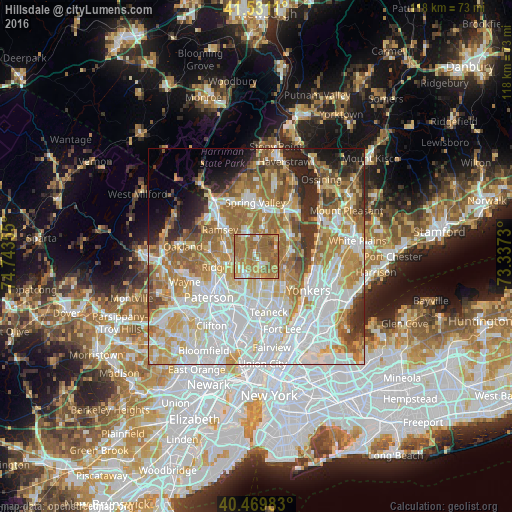
Analysis of Hillsdale night lights 2016
Square area 10x10 km:
 6.46%
6.46%90-99
6.8%80-89
6.63%70-79
20.58%60-69
41.84%50-59
16.16%40-49
1.53%30-39
0%20-29
0%10-19
0%0-9
0%Square area 50x50 km:
20.71%90-99
15.51%80-89
7.68%70-79
10.52%60-69
12.47%50-59
7.19%40-49
4.43%30-39
3.75%20-29
5.34%10-19
4.47%0-9
7.93%Clear (daylight) street map image can be seen on geolist.org.
Map coordinates:
41° 31' 52" North, 74° 44' 36.8" West
41° 0' 9.4" North, 74° 2' 25.5" West
40° 28' 11.4" North, 73° 20' 14.3" West
Some cities around Hillsdale sort by population:
• Westwood
1.4 km =0.9 mi,  152°
152°
• River Vale
2.5 km =1.6 mi,  108°
108°
• Park Ridge
3.9 km =2.4 mi,  359°
359°
• Montvale
5.1 km =3.2 mi,  16°
16°
• Oradell
4.9 km =3 mi,  176°
176°
• Emerson
3.2 km =2 mi,  157°
157°
• Old Tappan
4.2 km =2.6 mi,  77°
77°
• Woodcliff Lake
3.2 km =2 mi,  316°
316°
5099087 (p: 10,559)
Sources (retrieved 2019-11-25):
» Earth at Night: Flat Maps 2012, 2016