Harrison night lights from space
Night Light of Harrison (Arkansas) from space (United States) Src. Average luminocity for 10x10km area is 35.3357% and for 50x50km: 2.3774%.
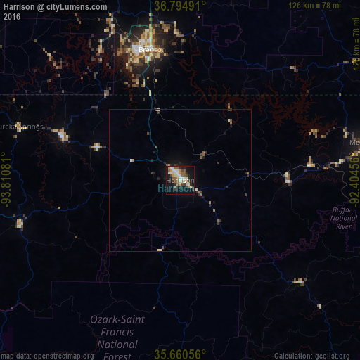
Analysis of Harrison night lights 2016
Square area 10x10 km:
 5.42%
5.42%90-99
7.17%80-89
2.8%70-79
5.07%60-69
2.45%50-59
9.09%40-49
3.5%30-39
4.02%20-29
6.47%10-19
35.84%0-9
18.18%Square area 50x50 km:
0.21%90-99
0.39%80-89
0.2%70-79
0.23%60-69
0.21%50-59
0.53%40-49
0.29%30-39
0.48%20-29
0.57%10-19
2.16%0-9
94.73%Clear (daylight) street map image can be seen on geolist.org.
Map coordinates:
36° 47' 41.7" North, 93° 48' 38.9" West
36° 13' 47.2" North, 93° 6' 27.6" West
35° 39' 38" North, 92° 24' 16.4" West
Some cities around Harrison sort by population:
• Springdale
91.7 km =57 mi,  267°
267°
• Rogers
91.3 km =56.7 mi,  277°
277°
• Ozark
88.4 km =54.9 mi,  354°
354°
• Mountain Home
65.8 km =40.9 mi,  79°
79°
• Branson
47.1 km =29.3 mi, 347°
• Clarksville
90.3 km =56.1 mi,  200°
200°
• Lowell
91.8 km =57 mi, 271°
• Berryville
43.9 km =27.3 mi,  289°
289°
4113956 (p: 13,138)
Sources (retrieved 2019-11-25):
» Earth at Night: Flat Maps 2012, 2016