Haddonfield night lights from space
Night Light of Haddonfield (New Jersey) from space (United States) Src. Average luminocity for 10x10km area is 93.7228% and for 50x50km: 70.6845%.
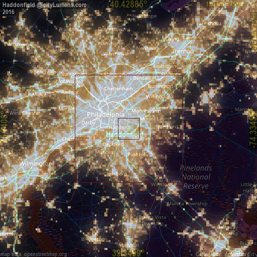
Analysis of Haddonfield night lights 2016
Square area 10x10 km:
 33.67%
90-99
38.95%80-89
19.73%70-79
7.65%60-69
0%50-59
0%40-49
0%30-39
0%20-29
0%10-19
0%0-9
0%Square area 50x50 km:
23.12%90-99
15.99%80-89
9.46%70-79
11.46%60-69
9.49%50-59
6.11%40-49
5.49%30-39
4.92%20-29
3.72%10-19
5.33%0-9
4.89%Clear (daylight) street map image can be seen on geolist.org.
Map coordinates:
40° 25' 43.9" North, 75° 44' 26.9" West
39° 53' 29.4" North, 75° 2' 15.6" West
39° 20' 59.6" North, 74° 20' 4.4" West
Some cities around Haddonfield sort by population:
• Cherry Hill
4.9 km =3 mi,  7°
7°
• Cherry Hill Mall
5.5 km =3.4 mi,  26°
26°
• Collingswood
4.1 km =2.5 mi,  315°
315°
• Audubon
3 km =1.9 mi,  268°
268°
• Runnemede
5.1 km =3.2 mi,  210°
210°
• Ashland
4.2 km =2.6 mi,  139°
139°
• Barrington
3.3 km =2.1 mi, 206°
• Somerdale
5.4 km =3.4 mi,  166°
166°
4502103 (p: 11,414)
Sources (retrieved 2019-11-25):
» Earth at Night: Flat Maps 2012, 2016