Goodyear night lights from space
Night Light of Goodyear (Arizona) from space (United States) Src. Average luminocity for 10x10km area is 75.6783% and for 50x50km: 42.6014%.
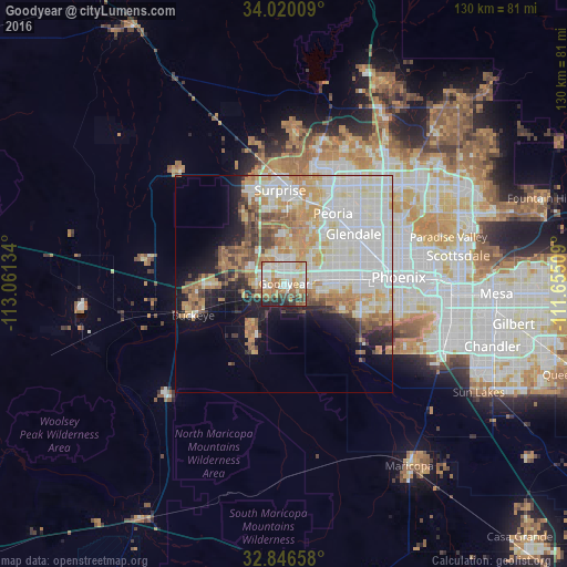
Analysis of Goodyear night lights 2016
Square area 10x10 km:
 19.06%
90-99
24.3%80-89
9.62%70-79
10.66%60-69
12.24%50-59
5.24%40-49
5.59%30-39
4.2%20-29
9.09%10-19
0%0-9
0%Square area 50x50 km:
12.09%90-99
12.05%80-89
4.44%70-79
6.4%60-69
5.39%50-59
3.85%40-49
2.96%30-39
2.34%20-29
3.93%10-19
7.93%0-9
38.63%Clear (daylight) street map image can be seen on geolist.org.
Map coordinates:
34° 1' 12.3" North, 113° 3' 40.8" West
33° 26' 7.2" North, 112° 21' 29.6" West
32° 50' 47.7" North, 111° 39' 18.3" West
Some cities around Goodyear sort by population:
• Maryvale
18.3 km =11.4 mi,  66°
66°
• Peoria
19.7 km =12.2 mi,  34°
34°
• Avondale
0.8 km =0.5 mi,  87°
87°
• Sun City
19.7 km =12.2 mi,  23°
23°
• Tolleson
9.3 km =5.8 mi,  79°
79°
• Youngtown
18.4 km =11.4 mi, 16°
• Laveen
19.3 km =12 mi,  114°
114°
• Litchfield Park
6.5 km =4 mi,  0°
0°
5296266 (p: 79,003)
Sources (retrieved 2019-11-25):
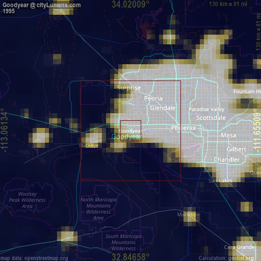
» NASA, Earths city lights 1995
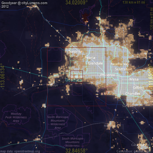
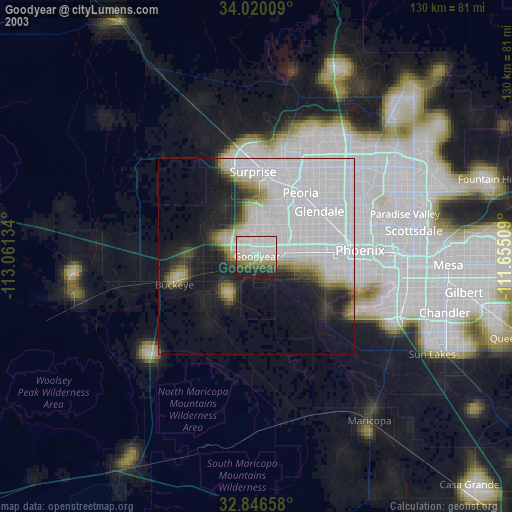
» NASA city lights 2003
» Earth at Night: Flat Maps 2012, 2016