Gonzalez night lights from space
Night Light of Gonzalez (Florida) from space (United States) Src. Average luminocity for 10x10km area is 66.7344% and for 50x50km: 27.6152%.
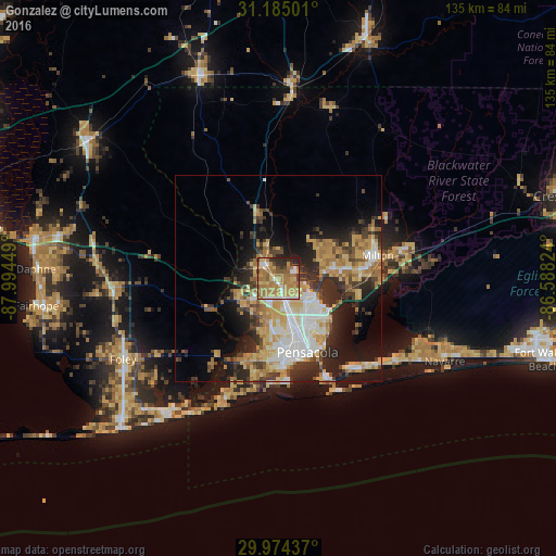
Analysis of Gonzalez night lights 2016
Square area 10x10 km:
 4.58%
4.58%90-99
8.24%80-89
10.26%70-79
21.79%60-69
32.05%50-59
6.23%40-49
4.95%30-39
3.85%20-29
6.96%10-19
1.1%0-9
0%Square area 50x50 km:
4.24%90-99
4.26%80-89
4.62%70-79
5.36%60-69
5.24%50-59
1.99%40-49
3.13%30-39
4.54%20-29
7.02%10-19
10.78%0-9
48.81%Clear (daylight) street map image can be seen on geolist.org.
Map coordinates:
31° 11' 6" North, 87° 59' 40.2" West
30° 34' 53.7" North, 87° 17' 28.9" West
29° 58' 27.7" North, 86° 35' 17.7" West
Some cities around Gonzalez sort by population:
• Ferry Pass
11 km =6.8 mi,  136°
136°
• Cantonment
5.5 km =3.4 mi,  302°
302°
• Bellview
13.5 km =8.4 mi,  189°
189°
• Brent
13.6 km =8.5 mi,  157°
157°
• West Pensacola
17.3 km =10.7 mi,  176°
176°
• Ensley
7.2 km =4.5 mi,  165°
165°
• Pace
12.6 km =7.8 mi,  80°
80°
• Myrtle Grove
17.9 km =11.1 mi, 184°
4156975 (p: 13,273)
Sources (retrieved 2019-11-25):
» Earth at Night: Flat Maps 2012, 2016