Gloversville night lights from space
Night Light of Gloversville (New York) from space (United States) Src. Average luminocity for 10x10km area is 23.2% and for 50x50km: 3.2367%.
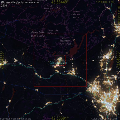
Analysis of Gloversville night lights 2016
Square area 10x10 km:
 0.95%
0.95%90-99
3.33%80-89
4.92%70-79
4.13%60-69
1.75%50-59
4.6%40-49
2.06%30-39
1.27%20-29
3.33%10-19
26.83%0-9
46.83%Square area 50x50 km:
0.11%90-99
0.25%80-89
0.52%70-79
0.63%60-69
0.57%50-59
0.46%40-49
0.4%30-39
0.35%20-29
0.55%10-19
2.87%0-9
93.29%Clear (daylight) street map image can be seen on geolist.org.
Map coordinates:
43° 33' 52.2" North, 75° 2' 48.8" West
43° 3' 10.3" North, 74° 20' 37.5" West
42° 32' 12.9" North, 73° 38' 26.3" West
Some cities around Gloversville sort by population:
• Schenectady
42.3 km =26.3 mi,  128°
128°
• Saratoga Springs
45.5 km =28.3 mi,  85°
85°
• Rotterdam
42.4 km =26.3 mi, 134°
• Amsterdam
17.9 km =11.1 mi,  135°
135°
• Johnstown
5.5 km =3.4 mi,  200°
200°
• Scotia
39.8 km =24.7 mi, 129°
• East Glenville
38.1 km =23.7 mi,  117°
117°
• Ballston Spa
40.6 km =25.2 mi,  98°
98°
5118743 (p: 15,023)
Sources (retrieved 2019-11-25):
» Earth at Night: Flat Maps 2012, 2016