Amsterdam night lights from space
Night Light of Amsterdam (New York) from space (United States) Src. Average luminocity for 10x10km area is 24.2746% and for 50x50km: 8.0026%.
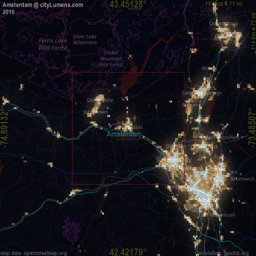
Analysis of Amsterdam night lights 2016
Square area 10x10 km:
 1.11%
1.11%90-99
2.7%80-89
2.22%70-79
8.41%60-69
2.7%50-59
2.86%40-49
4.44%30-39
2.38%20-29
5.24%10-19
22.54%0-9
45.4%Square area 50x50 km:
0.71%90-99
1.22%80-89
1.04%70-79
1.21%60-69
1.36%50-59
1.19%40-49
1.45%30-39
1.03%20-29
1.58%10-19
5%0-9
84.22%Clear (daylight) street map image can be seen on geolist.org.
Map coordinates:
43° 27' 4.6" North, 74° 53' 28.8" West
42° 56' 19.3" North, 74° 11' 17.5" West
42° 25' 18.4" North, 73° 29' 6.3" West
Some cities around Amsterdam sort by population:
• Schenectady
24.5 km =15.2 mi,  124°
124°
• Saratoga Springs
36.5 km =22.7 mi,  63°
63°
• Rotterdam
24.5 km =15.2 mi,  133°
133°
• Gloversville
17.9 km =11.1 mi,  315°
315°
• Johnstown
16.4 km =10.2 mi,  297°
297°
• Scotia
22.1 km =13.7 mi, 124°
• East Glenville
21.8 km =13.5 mi,  103°
103°
• Ballston Spa
28.4 km =17.6 mi,  75°
75°
5107152 (p: 18,008)
Sources (retrieved 2019-11-25):
» Earth at Night: Flat Maps 2012, 2016