Fountain night lights from space
Night Light of Fountain (Colorado) from space (United States) Src. Average luminocity for 10x10km area is 31.4813% and for 50x50km: 14.8839%.
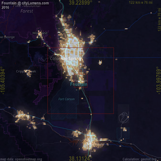

Analysis of Fountain night lights 2016
Square area 10x10 km:
 1.19%
1.19%90-99
1.7%80-89
3.23%70-79
6.8%60-69
8.16%50-59
4.25%40-49
4.08%30-39
7.14%20-29
15.31%10-19
29.25%0-9
18.88%Square area 50x50 km:
3.18%90-99
3.43%80-89
2.11%70-79
2.27%60-69
2.05%50-59
1.74%40-49
0.91%30-39
1.54%20-29
2.82%10-19
4.29%0-9
75.66%Clear (daylight) street map image can be seen on geolist.org.
Map coordinates:
39° 13' 44.4" North, 105° 24' 14.2" West
38° 40' 56" North, 104° 42' 2.9" West
38° 7' 52.5" North, 103° 59' 51.7" West
Some cities around Fountain sort by population:
• Colorado Springs
19.8 km =12.3 mi,  328°
328°
• Security-Widefield
7.3 km =4.5 mi,  350°
350°
• Pueblo West
37 km =23 mi,  182°
182°
• Cimarron Hills
19.6 km =12.2 mi,  0°
0°
• Fort Carson
9.8 km =6.1 mi,  308°
308°
• Black Forest
36.8 km =22.9 mi, 0°
• Stratmoor
12.3 km =7.6 mi, 326°
• Manitou Springs
27.2 km =16.9 mi,  316°
316°
5422191 (p: 27,767)
Sources (retrieved 2019-11-25):
» Earth at Night: Flat Maps 2012, 2016