Stratmoor night lights from space
Night Light of Stratmoor (Colorado) from space (United States) Src. Average luminocity for 10x10km area is 82.8878% and for 50x50km: 21.5268%.
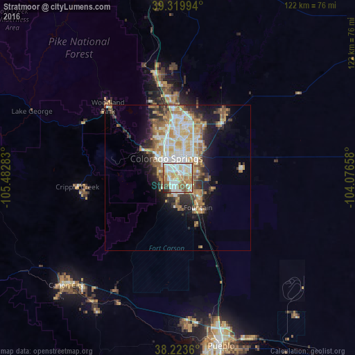
Analysis of Stratmoor night lights 2016
Square area 10x10 km:
 23.3%
23.3%90-99
27.89%80-89
11.05%70-79
11.9%60-69
12.07%50-59
9.35%40-49
1.19%30-39
2.04%20-29
1.19%10-19
0%0-9
0%Square area 50x50 km:
4.19%90-99
4.63%80-89
2.97%70-79
3.68%60-69
3.12%50-59
2.83%40-49
1.65%30-39
2.49%20-29
3.81%10-19
6.66%0-9
63.98%Clear (daylight) street map image can be seen on geolist.org.
Map coordinates:
39° 19' 11.8" North, 105° 28' 58.2" West
38° 46' 26" North, 104° 46' 46.9" West
38° 13' 25" North, 104° 4' 35.7" West
Some cities around Stratmoor sort by population:
• Colorado Springs
7.6 km =4.7 mi,  331°
331°
• Security-Widefield
6.4 km =4 mi,  117°
117°
• Fountain
12.3 km =7.6 mi,  146°
146°
• Cimarron Hills
11.7 km =7.3 mi,  36°
36°
• Fort Carson
4.1 km =2.5 mi,  191°
191°
• Black Forest
27.5 km =17.1 mi,  14°
14°
• Air Force Academy
25.6 km =15.9 mi,  343°
343°
• Manitou Springs
15.3 km =9.5 mi,  308°
308°
5440520 (p: 6,900)
Sources (retrieved 2019-11-25):
» Earth at Night: Flat Maps 2012, 2016