Floral Park night lights from space
Night Light of Floral Park (New York) from space (United States) Src. Average luminocity for 10x10km area is 99.7208% and for 50x50km: 65.5547%.
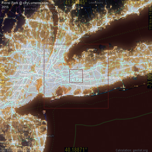
Analysis of Floral Park night lights 2016
Square area 10x10 km:
 77.44%
90-99
22.56%80-89
0%70-79
0%60-69
0%50-59
0%40-49
0%30-39
0%20-29
0%10-19
0%0-9
0%Square area 50x50 km:
34.81%90-99
14.02%80-89
4.13%70-79
4.58%60-69
4.73%50-59
3.89%40-49
3.25%30-39
2.93%20-29
4.93%10-19
7.13%0-9
15.6%Clear (daylight) street map image can be seen on geolist.org.
Map coordinates:
41° 15' 16" North, 74° 24' 28.7" West
40° 43' 25.4" North, 73° 42' 17.5" West
40° 11' 19.4" North, 73° 0' 6.2" West
Some cities around Floral Park sort by population:
• Queens Village
3.1 km =1.9 mi,  276°
276°
• Elmont
2.6 km =1.6 mi,  195°
195°
• Franklin Square
3 km =1.9 mi,  126°
126°
• North Valley Stream
4.3 km =2.7 mi,  176°
176°
• North New Hyde Park
2.4 km =1.5 mi,  24°
24°
• New Hyde Park
1.9 km =1.2 mi,  48°
48°
• Garden City Park
4 km =2.5 mi,  61°
61°
• Glen Oaks
2.7 km =1.7 mi,  347°
347°
5117438 (p: 15,969)
Sources (retrieved 2019-11-25):
» Earth at Night: Flat Maps 2012, 2016