Farmington night lights from space
Night Light of Farmington (Missouri) from space (United States) Src. Average luminocity for 10x10km area is 39.3963% and for 50x50km: 5.899%.
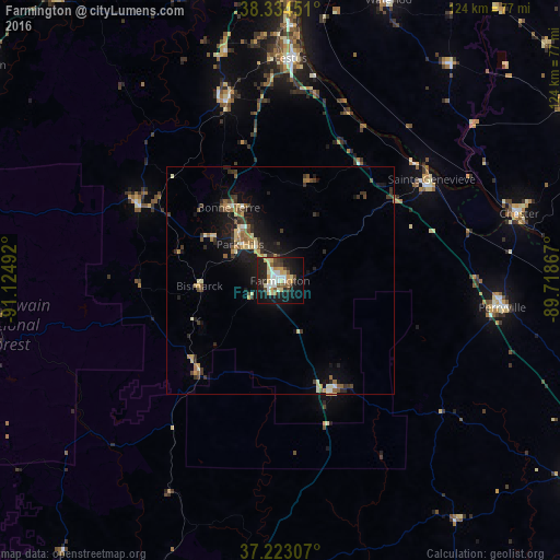
Analysis of Farmington night lights 2016
Square area 10x10 km:
 5.95%
5.95%90-99
6.97%80-89
9.01%70-79
4.93%60-69
2.89%50-59
3.57%40-49
3.91%30-39
4.59%20-29
12.93%10-19
30.27%0-9
14.97%Square area 50x50 km:
0.38%90-99
0.65%80-89
1.04%70-79
0.64%60-69
0.66%50-59
0.9%40-49
0.76%30-39
1.38%20-29
1.49%10-19
5.34%0-9
86.76%Clear (daylight) street map image can be seen on geolist.org.
Map coordinates:
38° 20' 4.2" North, 91° 7' 29.7" West
37° 46' 51.2" North, 90° 25' 18.4" West
37° 13' 23.1" North, 89° 43' 7.2" West
Some cities around Farmington sort by population:
• Festus
48.9 km =30.4 mi,  2°
2°
• Park Hills
11.8 km =7.3 mi,  313°
313°
• Chester
54.7 km =34 mi,  74°
74°
• Perryville
49.7 km =30.9 mi,  97°
97°
• Bonne Terre
19.7 km =12.2 mi,  323°
323°
• De Soto
41.6 km =25.8 mi,  343°
343°
• Pevely
55.9 km =34.7 mi, 2°
• Flat River
11.3 km =7 mi, 312°
4386289 (p: 18,181)
Sources (retrieved 2019-11-25):
» Earth at Night: Flat Maps 2012, 2016