Fair Lawn night lights from space
Night Light of Fair Lawn (New Jersey) from space (United States) Src. Average luminocity for 10x10km area is 91.6752% and for 50x50km: 72.2865%.
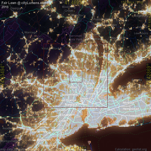
Analysis of Fair Lawn night lights 2016
Square area 10x10 km:
 38.27%
90-99
28.4%80-89
14.97%70-79
14.29%60-69
4.08%50-59
0%40-49
0%30-39
0%20-29
0%10-19
0%0-9
0%Square area 50x50 km:
27.17%90-99
15.7%80-89
7.48%70-79
9.82%60-69
12.91%50-59
6.75%40-49
3.47%30-39
3.08%20-29
3.75%10-19
3.1%0-9
6.77%Clear (daylight) street map image can be seen on geolist.org.
Map coordinates:
41° 28' 9.8" North, 74° 50' 5.8" West
40° 56' 25.4" North, 74° 7' 54.5" West
40° 24' 25.6" North, 73° 25' 43.3" West
Some cities around Fair Lawn sort by population:
• Paterson
4.3 km =2.7 mi,  232°
232°
• Paramus
4.8 km =3 mi,  84°
84°
• Ridgewood
4.5 km =2.8 mi,  16°
16°
• Elmwood Park
4.2 km =2.6 mi,  164°
164°
• Hawthorne
2.1 km =1.3 mi,  298°
298°
• Glen Rock
2.5 km =1.6 mi,  357°
357°
• Haledon
4.6 km =2.9 mi,  263°
263°
• Prospect Park
3.6 km =2.2 mi, 264°
5097773 (p: 33,597)
Sources (retrieved 2019-11-25):
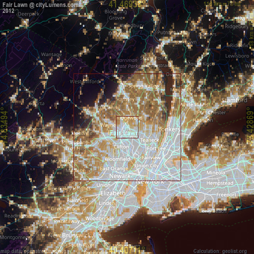
» Earth at Night: Flat Maps 2012, 2016