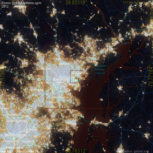
Essex night lights from space
Night Light of Essex (Maryland) from space (United States) Src. Average luminocity for 10x10km area is 88.2466% and for 50x50km: 52.2817%.
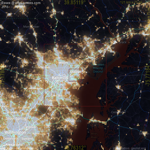
Analysis of Essex night lights 2016
Square area 10x10 km:
 36.73%
90-99
30.27%80-89
9.86%70-79
7.14%60-69
6.12%50-59
4.42%40-49
2.04%30-39
2.21%20-29
1.19%10-19
0%0-9
0%Square area 50x50 km:
17.16%90-99
12.26%80-89
5.37%70-79
6.52%60-69
6.59%50-59
5.55%40-49
5.25%30-39
4.72%20-29
5.93%10-19
6.15%0-9
24.49%Clear (daylight) street map image can be seen on geolist.org.
Map coordinates:
39° 51' 4.3" North, 77° 10' 41.1" West
39° 18' 33.4" North, 76° 28' 29.9" West
38° 45' 47.2" North, 75° 46' 18.6" West
Some cities around Essex sort by population:
• Dundalk
7.6 km =4.7 mi,  211°
211°
• Middle River
4.1 km =2.5 mi,  47°
47°
• Rosedale
3.7 km =2.3 mi,  289°
289°
• Rossville
3.3 km =2.1 mi,  352°
352°
• Overlea
7.2 km =4.5 mi,  326°
326°
• White Marsh
9.1 km =5.7 mi,  23°
23°
• Edgemere
7.8 km =4.8 mi,  162°
162°
• Bowleys Quarters
7.8 km =4.8 mi,  68°
68°
4354428 (p: 39,262)
Sources (retrieved 2019-11-25):
» Earth at Night: Flat Maps 2012, 2016