Dundalk night lights from space
Night Light of Dundalk (Maryland) from space (United States) Src. Average luminocity for 10x10km area is 83.9643% and for 50x50km: 56.7402%.
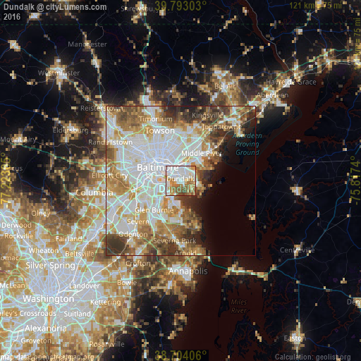
Analysis of Dundalk night lights 2016
Square area 10x10 km:
 36.05%
90-99
17.18%80-89
9.01%70-79
11.05%60-69
13.61%50-59
7.99%40-49
4.42%30-39
0.68%20-29
0%10-19
0%0-9
0%Square area 50x50 km:
18.39%90-99
13.6%80-89
6.52%70-79
7.22%60-69
7.45%50-59
6.66%40-49
5.28%30-39
4.9%20-29
4.11%10-19
3.81%0-9
22.06%Clear (daylight) street map image can be seen on geolist.org.
Map coordinates:
39° 47' 34.9" North, 77° 13' 25.1" West
39° 15' 2.4" North, 76° 31' 13.9" West
38° 42' 14.6" North, 75° 49' 2.6" West
Some cities around Dundalk sort by population:
• Baltimore
9 km =5.6 mi,  299°
299°
• Essex
7.6 km =4.7 mi,  31°
31°
• Rosedale
7.7 km =4.8 mi,  3°
3°
• Rossville
10.4 km =6.5 mi,  19°
19°
• Brooklyn Park
8.6 km =5.3 mi,  253°
253°
• Riviera Beach
9.4 km =5.8 mi,  173°
173°
• Edgemere
6.3 km =3.9 mi,  98°
98°
• Baltimore Highlands
10.2 km =6.3 mi,  258°
258°
4353765 (p: 63,597)
Sources (retrieved 2019-11-25):
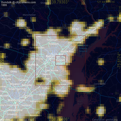
» NASA, Earths city lights 1995
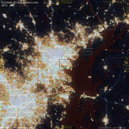
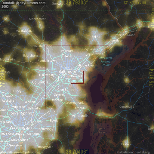
» NASA city lights 2003
» Earth at Night: Flat Maps 2012, 2016