West Des Moines night lights from space
Night Light of West Des Moines (Iowa) from space (United States) Src. Average luminocity for 10x10km area is 81.1266% and for 50x50km: 27.0437%.
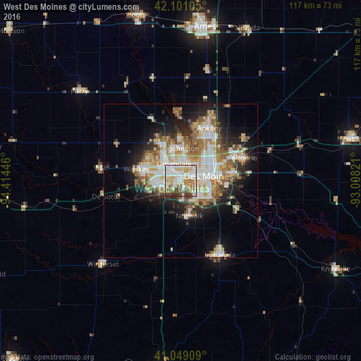
Analysis of West Des Moines night lights 2016
Square area 10x10 km:
 23.38%
90-99
25.81%80-89
13.96%70-79
9.09%60-69
9.09%50-59
6.01%40-49
7.79%30-39
3.41%20-29
1.46%10-19
0%0-9
0%Square area 50x50 km:
5.75%90-99
5.92%80-89
3.56%70-79
3.62%60-69
3.42%50-59
3.71%40-49
3.04%30-39
2.56%20-29
4.93%10-19
9.5%0-9
53.99%Clear (daylight) street map image can be seen on geolist.org.
Map coordinates:
42° 6' 3.8" North, 94° 24' 52.1" West
41° 34' 38" North, 93° 42' 40.8" West
41° 2' 56.7" North, 93° 0' 29.6" West
Some cities around West Des Moines sort by population:
• Des Moines
8.9 km =5.5 mi,  73°
73°
• Urbandale
5.5 km =3.4 mi,  359°
359°
• Johnston
10.7 km =6.6 mi,  6°
6°
• Waukee
15 km =9.3 mi,  284°
284°
• Clive
3.1 km =1.9 mi,  339°
339°
• Grimes
14 km =8.7 mi,  331°
331°
• Norwalk
11.6 km =7.2 mi,  166°
166°
• Pleasant Hill
15.9 km =9.9 mi,  87°
87°
4881346 (p: 64,113)
Sources (retrieved 2019-11-25):
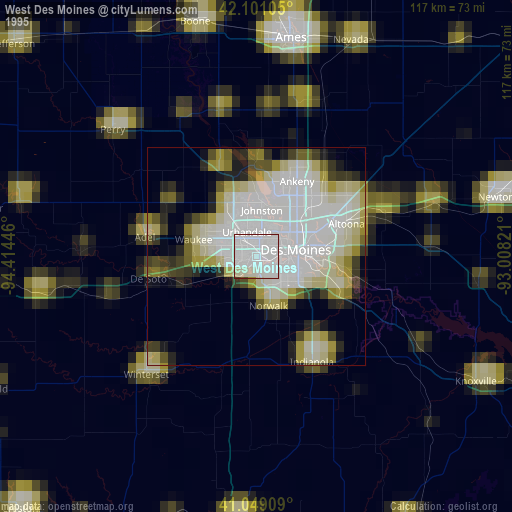
» NASA, Earths city lights 1995
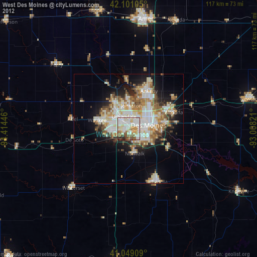
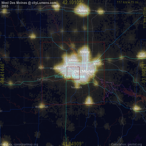
» NASA city lights 2003
» Earth at Night: Flat Maps 2012, 2016