Dalton night lights from space
Night Light of Dalton (Georgia) from space (United States) Src. Average luminocity for 10x10km area is 75.2692% and for 50x50km: 17.6054%.

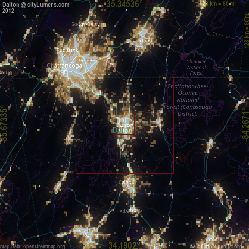
Analysis of Dalton night lights 2016
Square area 10x10 km:
 18.68%
90-99
19.96%80-89
12.64%70-79
10.44%60-69
12.45%50-59
8.24%40-49
6.04%30-39
6.23%20-29
5.31%10-19
0%0-9
0%Square area 50x50 km:
1.37%90-99
1.68%80-89
2.79%70-79
2.48%60-69
2.67%50-59
2.8%40-49
3.24%30-39
4.76%20-29
5.74%10-19
12.17%0-9
60.3%Clear (daylight) street map image can be seen on geolist.org.
Map coordinates:
35° 20' 43.3" North, 85° 40' 24.1" West
34° 46' 11.3" North, 84° 58' 12.8" West
34° 11' 24.7" North, 84° 16' 1.6" West
Some cities around Dalton sort by population:
• East Ridge
37.4 km =23.2 mi,  316°
316°
• Calhoun
29.8 km =18.5 mi,  176°
176°
• East Brainerd
30 km =18.6 mi,  326°
326°
• Collegedale
32.3 km =20.1 mi,  346°
346°
• Fort Oglethorpe
32.9 km =20.4 mi,  307°
307°
• Harrison
41.2 km =25.6 mi,  338°
338°
• LaFayette
29.4 km =18.3 mi,  255°
255°
• Fairview
34.7 km =21.6 mi,  304°
304°
4190581 (p: 33,853)
Sources (retrieved 2019-11-25):
» Earth at Night: Flat Maps 2012, 2016