Cushing night lights from space
Night Light of Cushing (Oklahoma) from space (United States) Src. Average luminocity for 10x10km area is 39.956% and for 50x50km: 4.3982%.
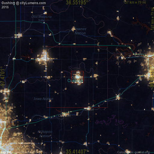
Analysis of Cushing night lights 2016
Square area 10x10 km:
 5.31%
5.31%90-99
5.68%80-89
5.49%70-79
2.56%60-69
8.42%50-59
10.99%40-49
4.58%30-39
6.78%20-29
7.51%10-19
27.47%0-9
15.2%Square area 50x50 km:
0.29%90-99
0.33%80-89
0.53%70-79
0.43%60-69
0.77%50-59
0.93%40-49
0.76%30-39
0.92%20-29
0.99%10-19
3.52%0-9
90.54%Clear (daylight) street map image can be seen on geolist.org.
Map coordinates:
36° 33' 7" North, 97° 28' 12.4" West
35° 59' 6.2" North, 96° 46' 1.1" West
35° 24' 50.7" North, 96° 3' 49.9" West
Some cities around Cushing sort by population:
• Stillwater
29.9 km =18.6 mi,  298°
298°
• Sapulpa
58.7 km =36.5 mi,  88°
88°
• Sand Springs
61.6 km =38.3 mi,  73°
73°
• Glenpool
68.3 km =42.4 mi, 92°
• Choctaw
70.6 km =43.9 mi,  219°
219°
• Guthrie
60.4 km =37.5 mi,  258°
258°
• Harrah
65.7 km =40.8 mi,  213°
213°
• Perry
57.8 km =35.9 mi,  305°
305°
4534659 (p: 7,867)
Sources (retrieved 2019-11-25):
» Earth at Night: Flat Maps 2012, 2016